Photography

Adventures in Bali by Kevin Hatcher

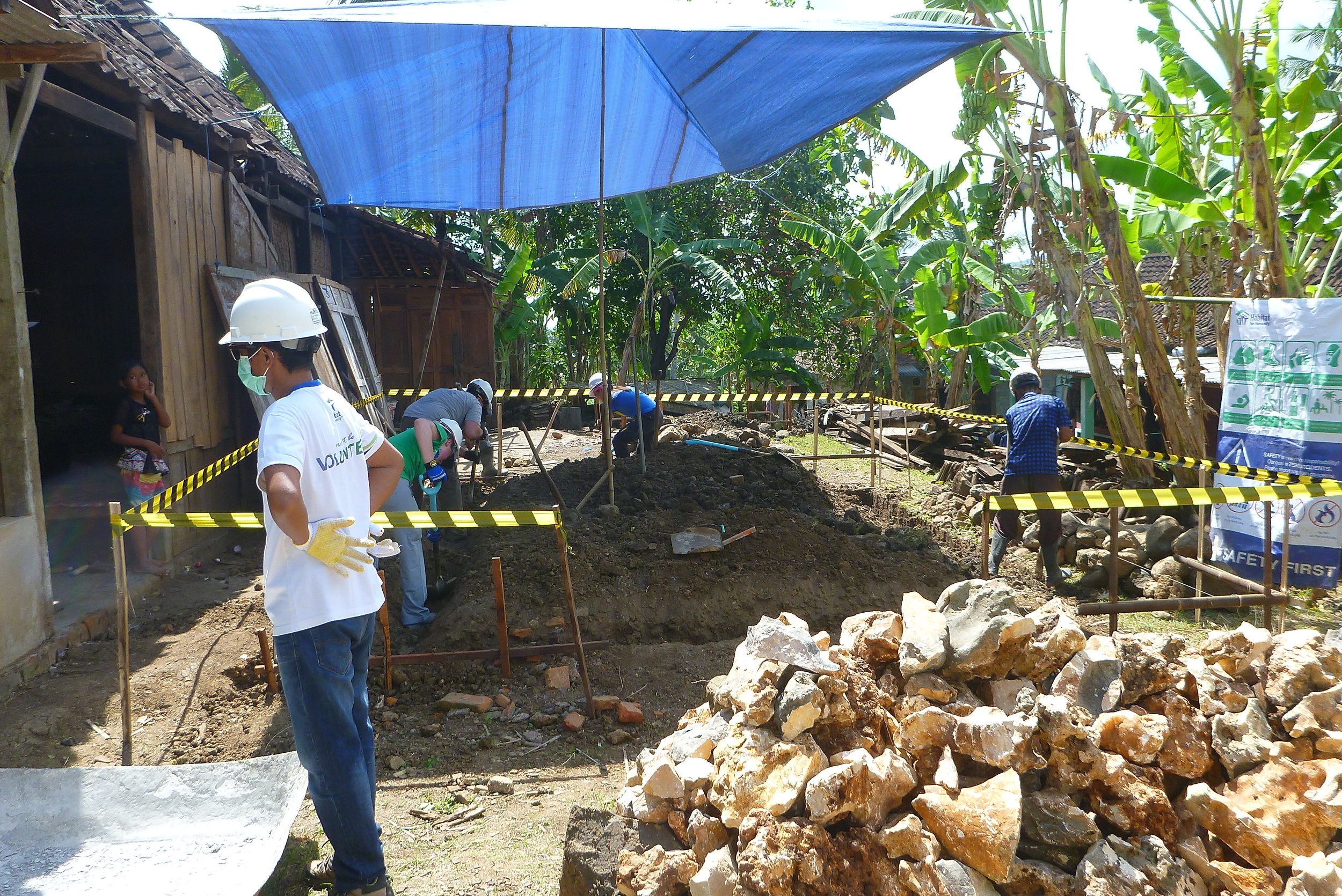
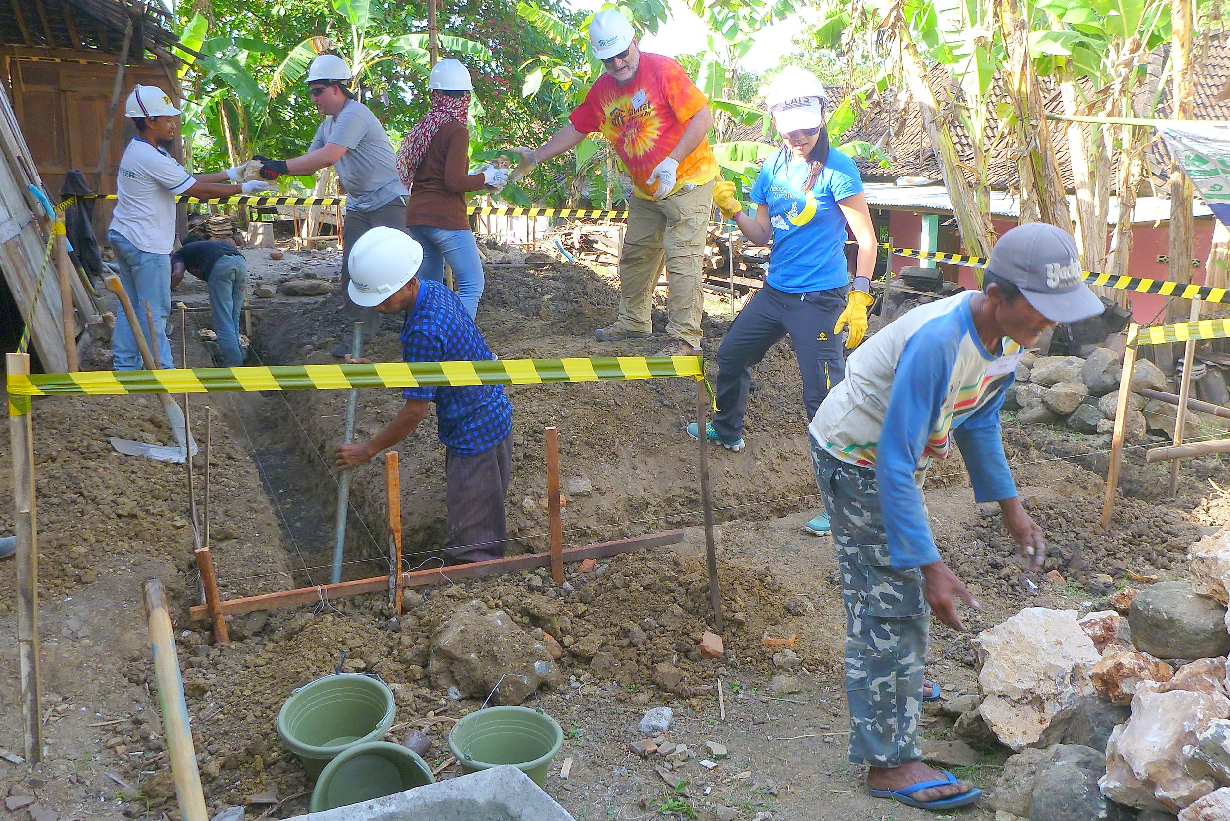
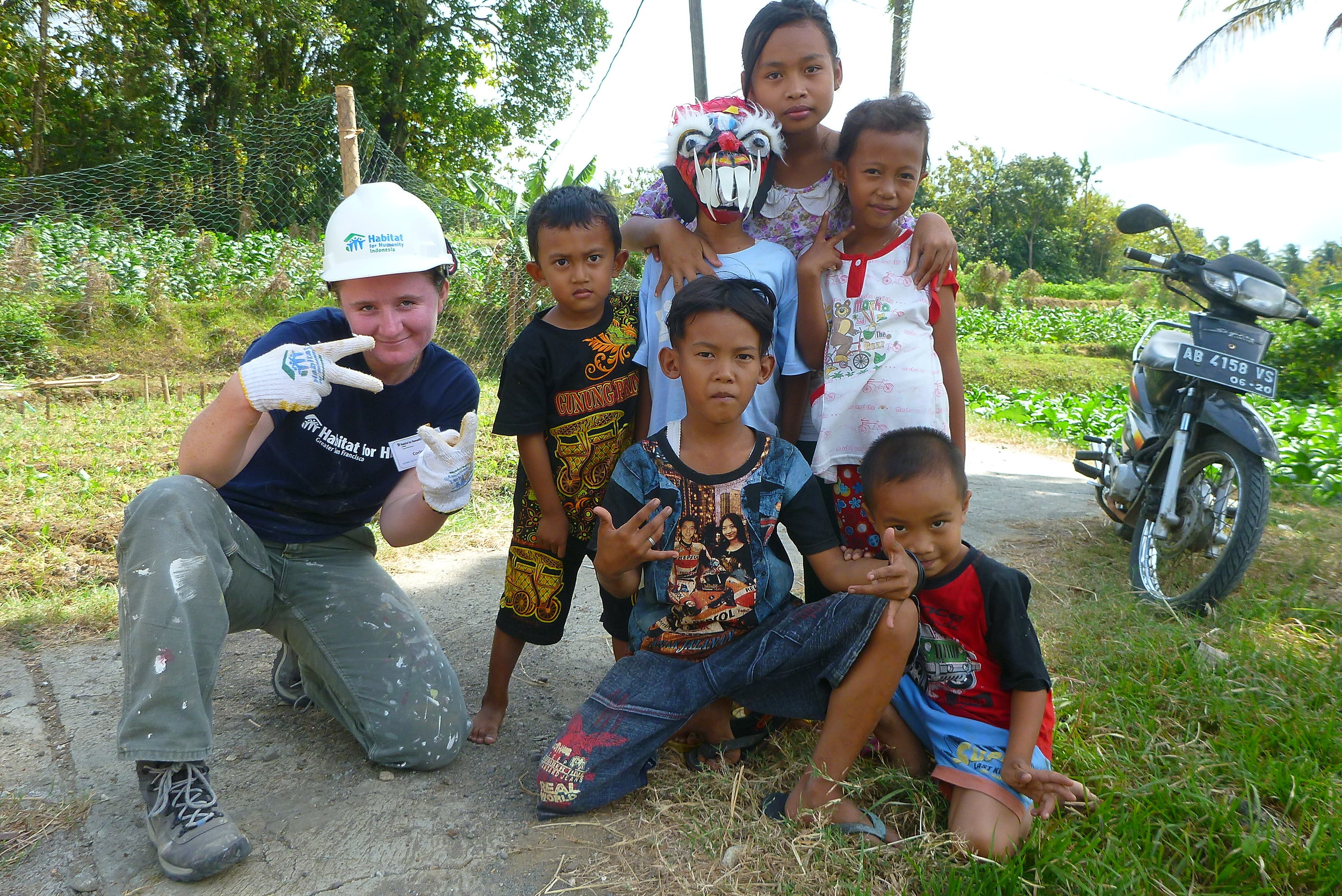
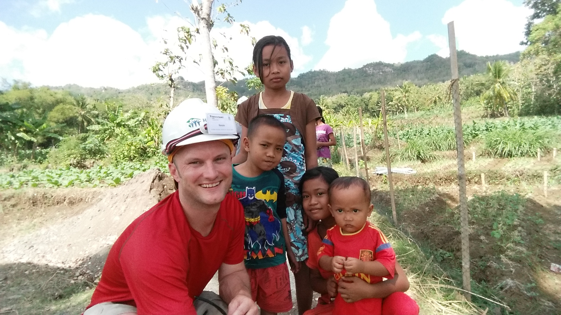
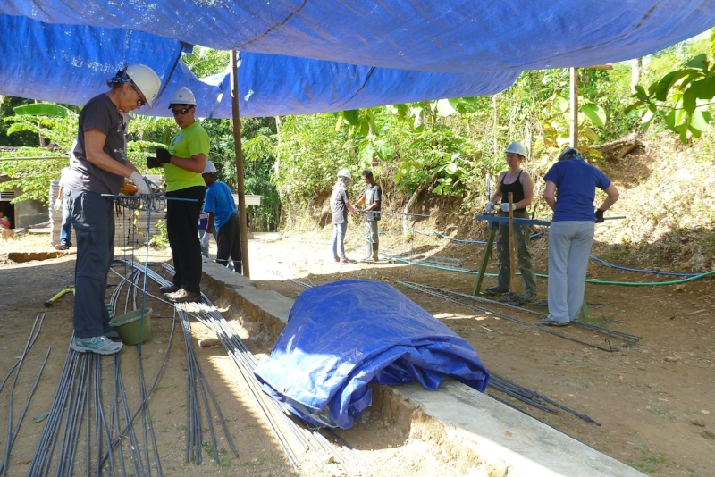
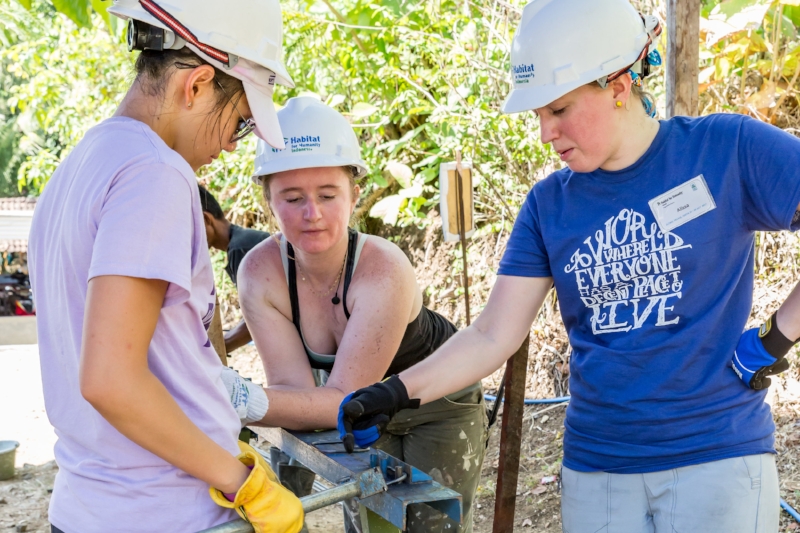
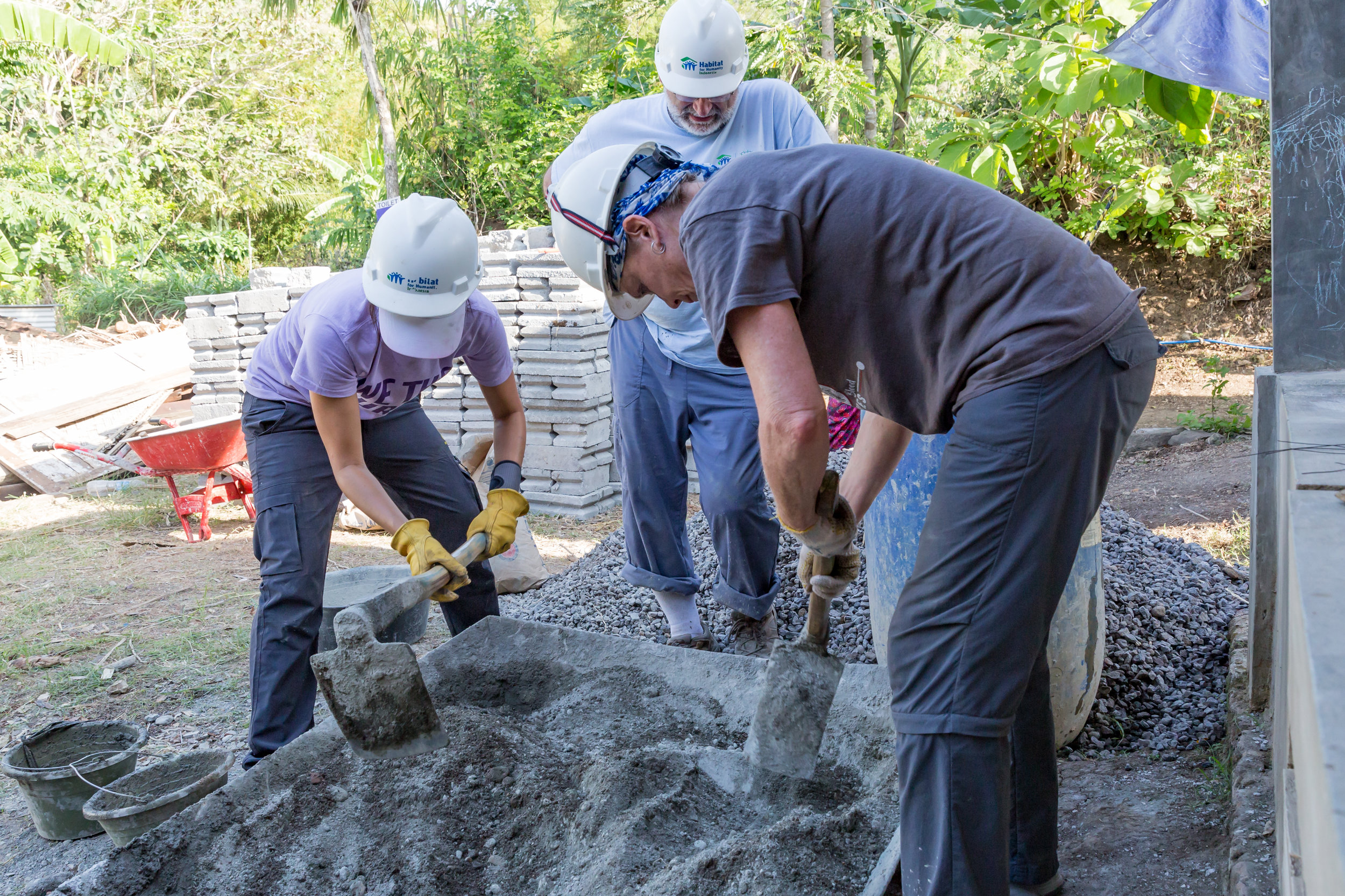
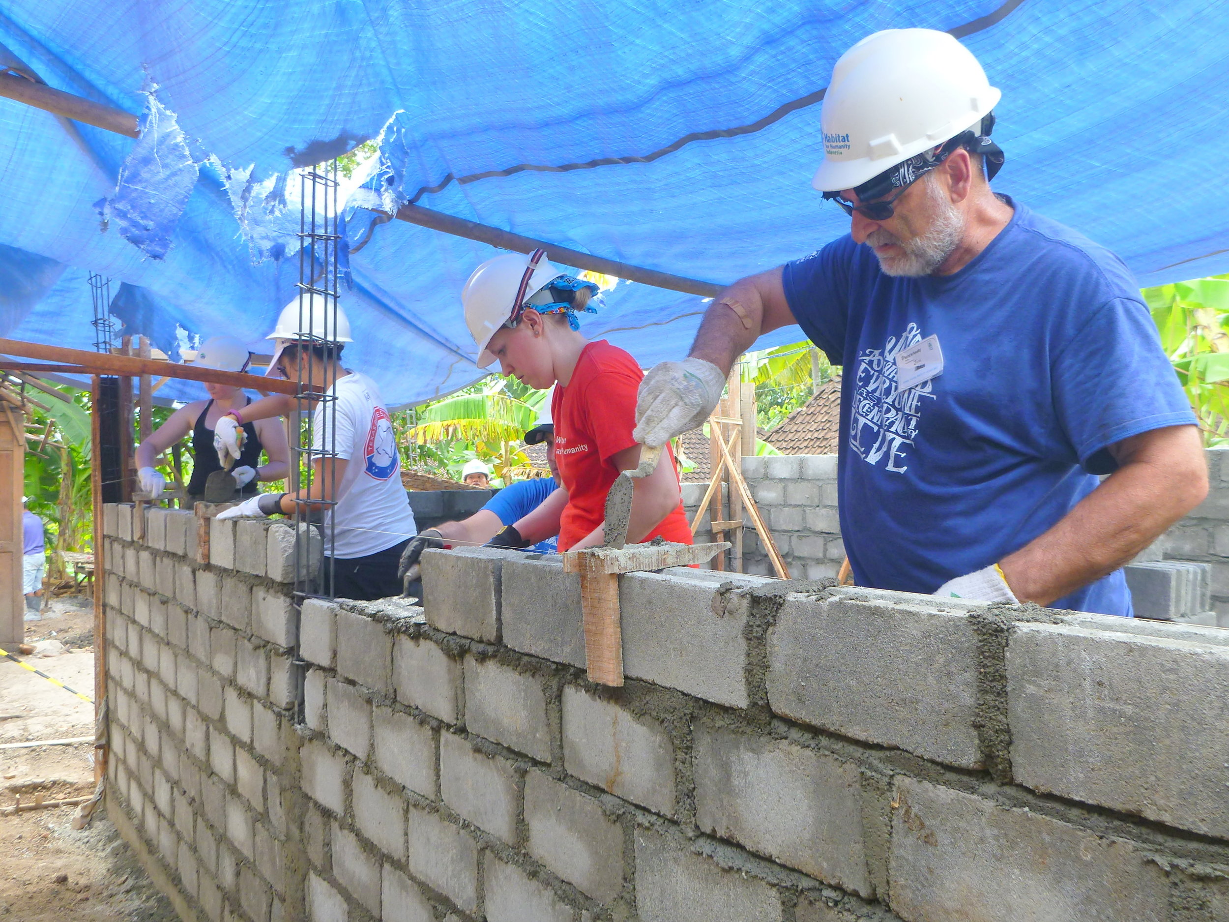
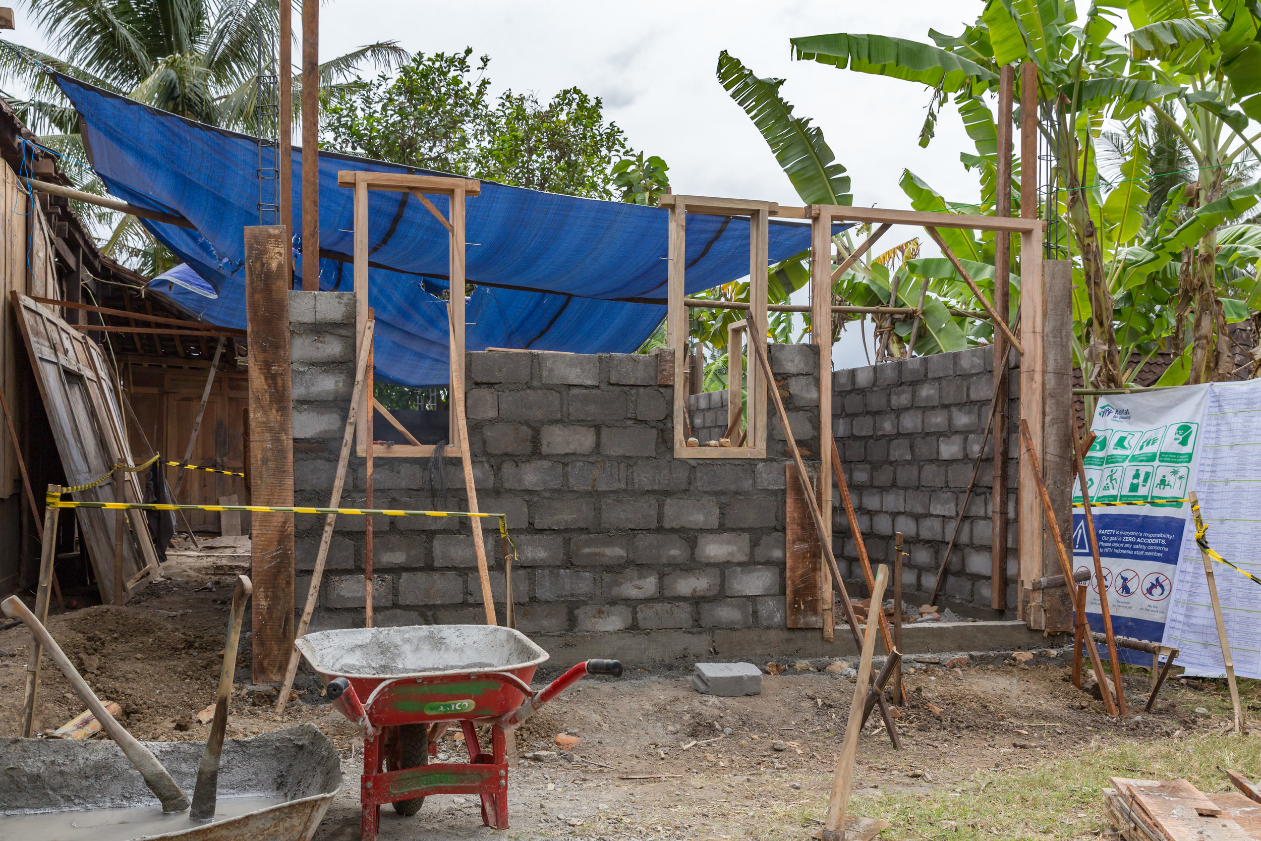
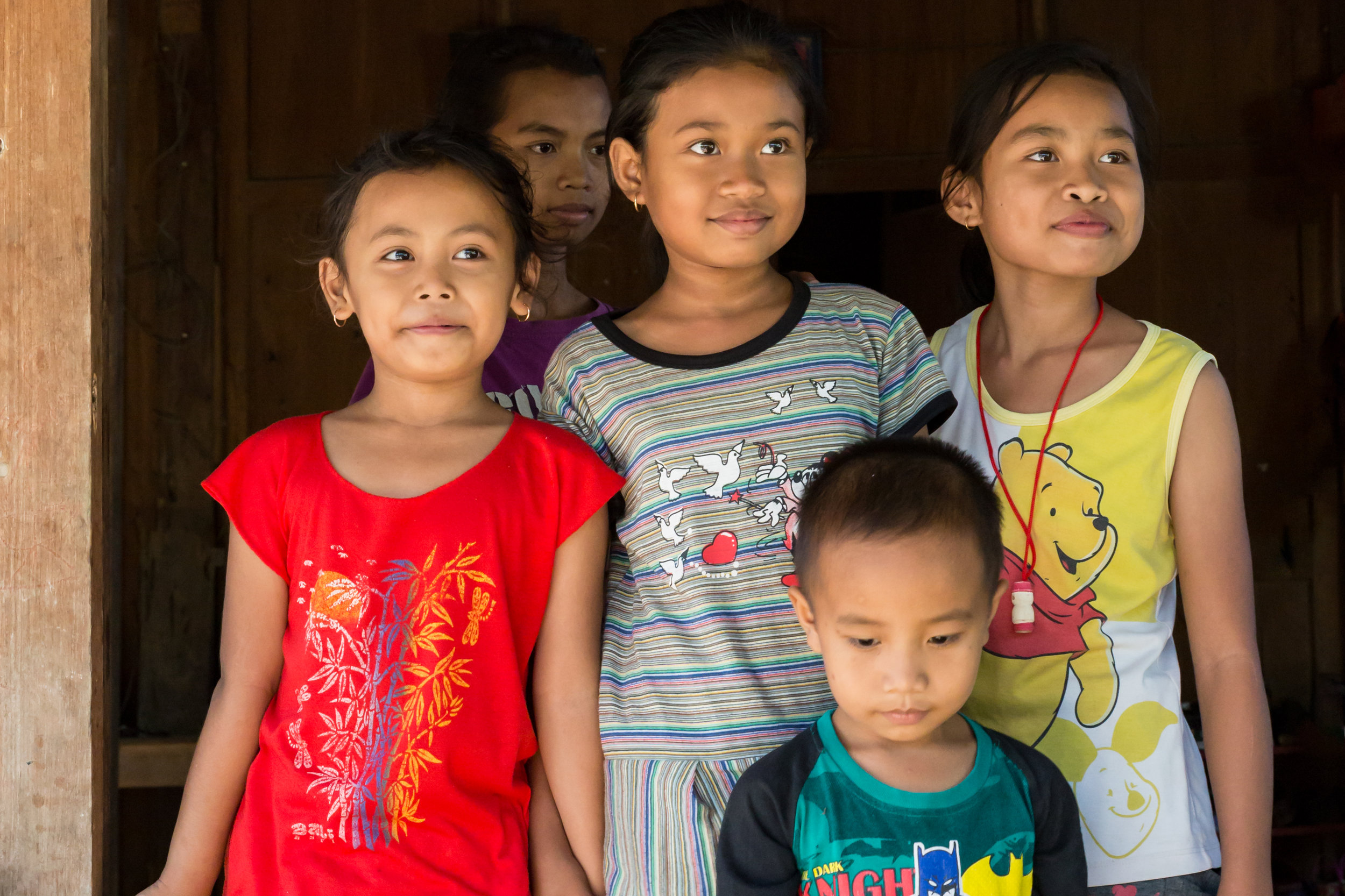
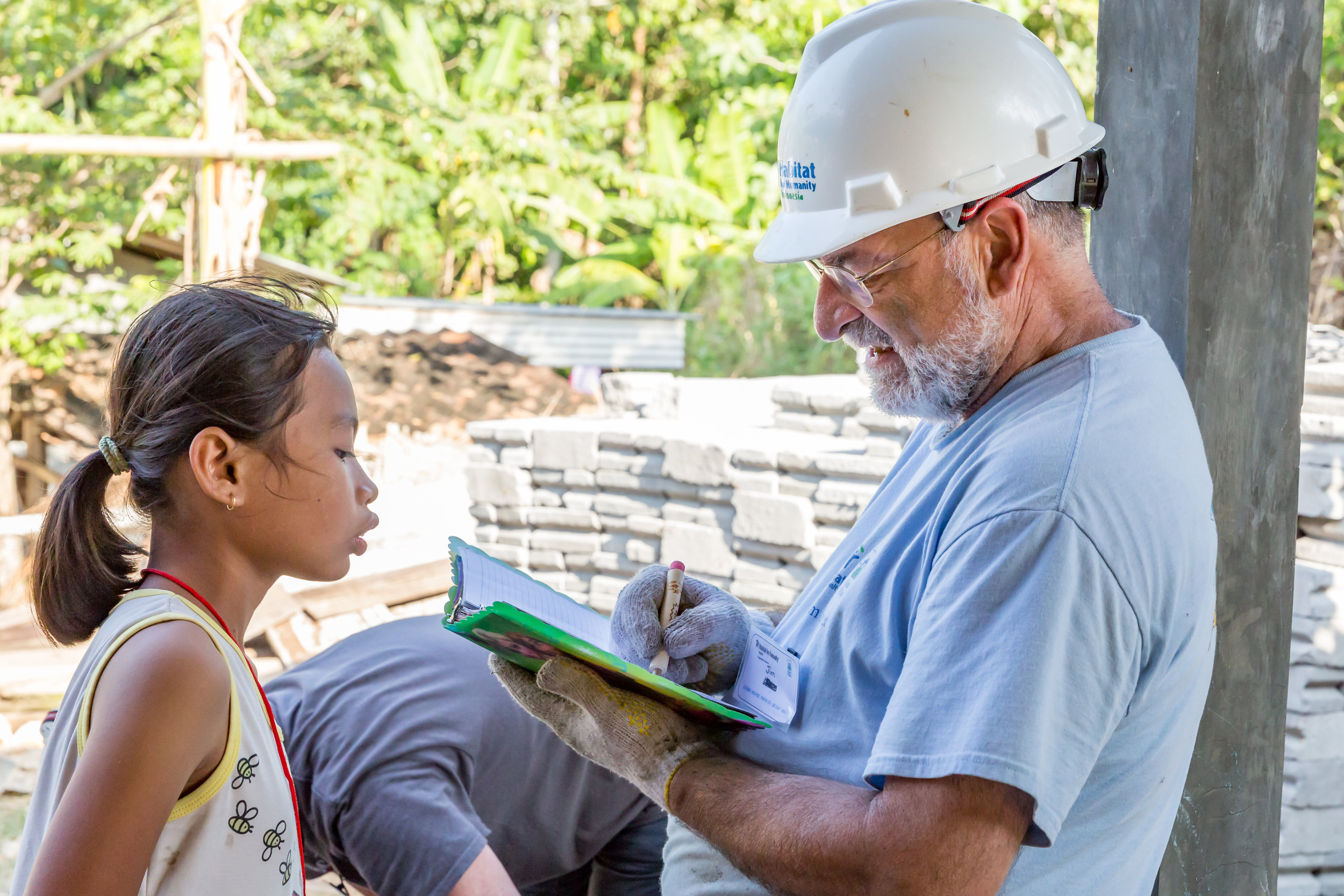
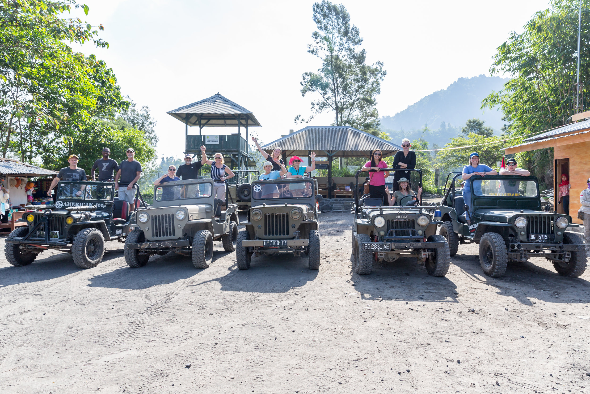
So, after a great two weeks spent building a house and exploring Yogjakarta, it was time to pack my bags, say goodbye to the Habitat for Humanity crew, and fly to Bali.

It was a very short visit to Bali, and I was going to be travelling with Mandy, Jeremy, and Alissa from the build crew.

Uluwatu - Beaches and scooters. 

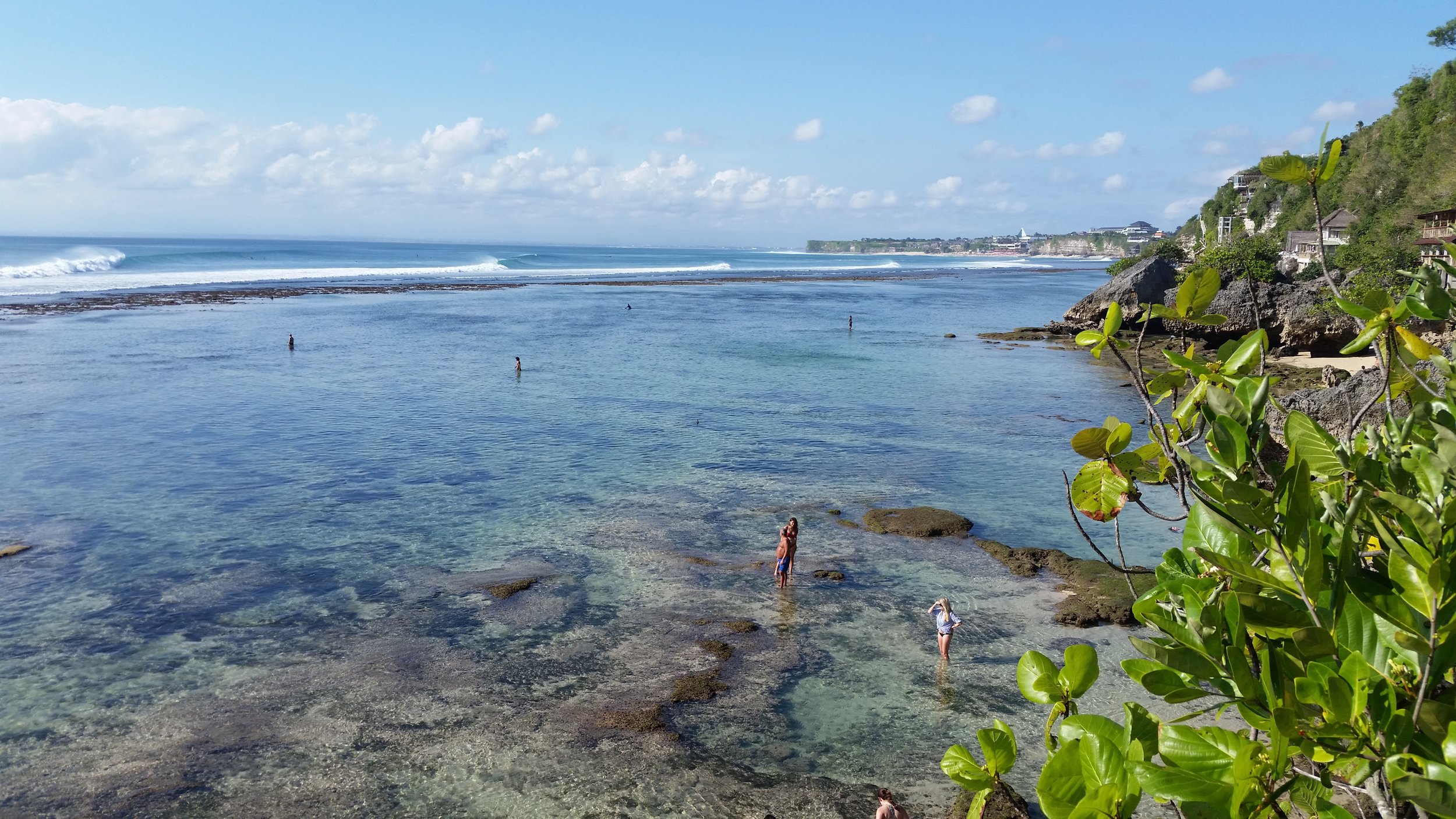
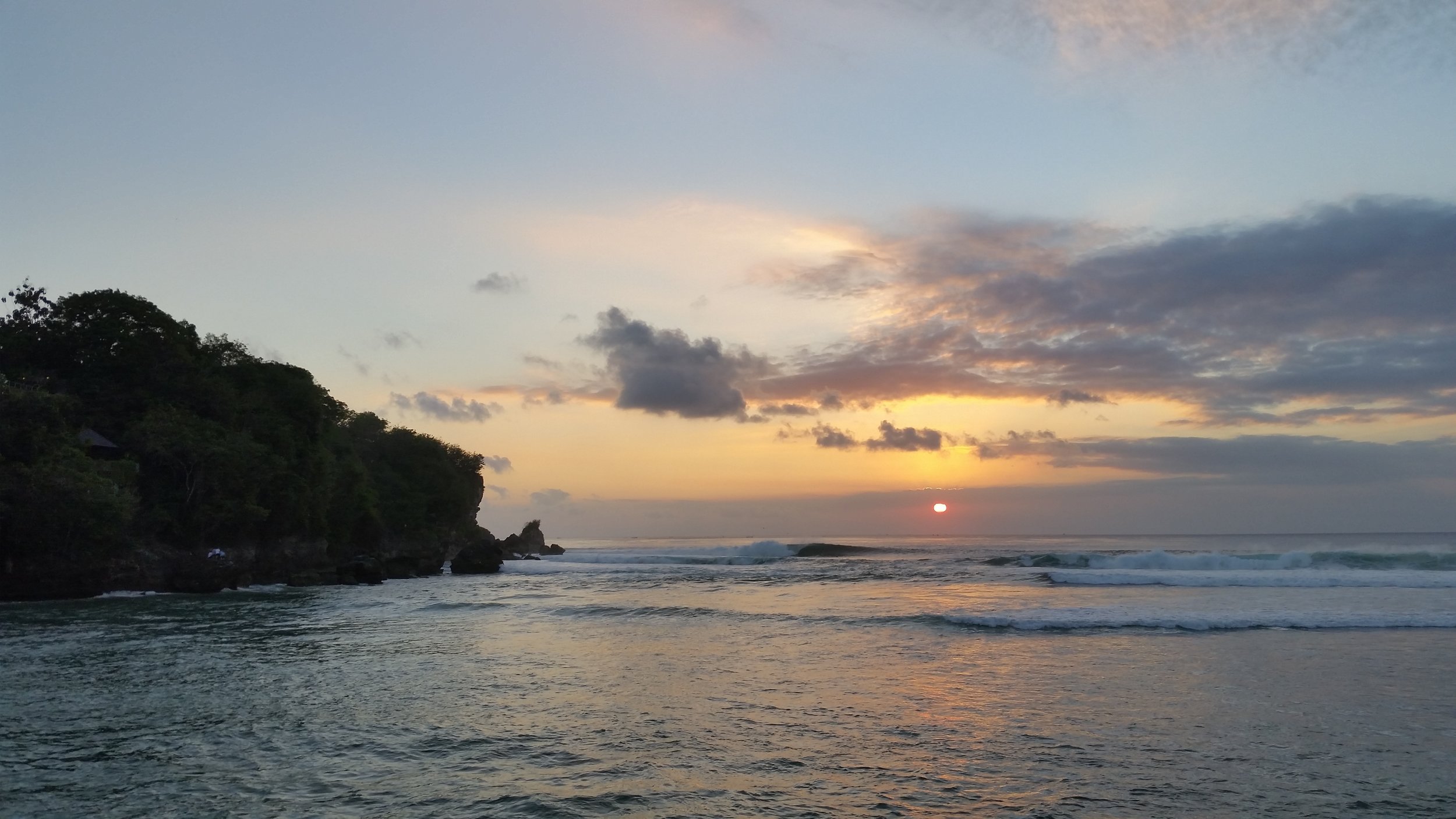
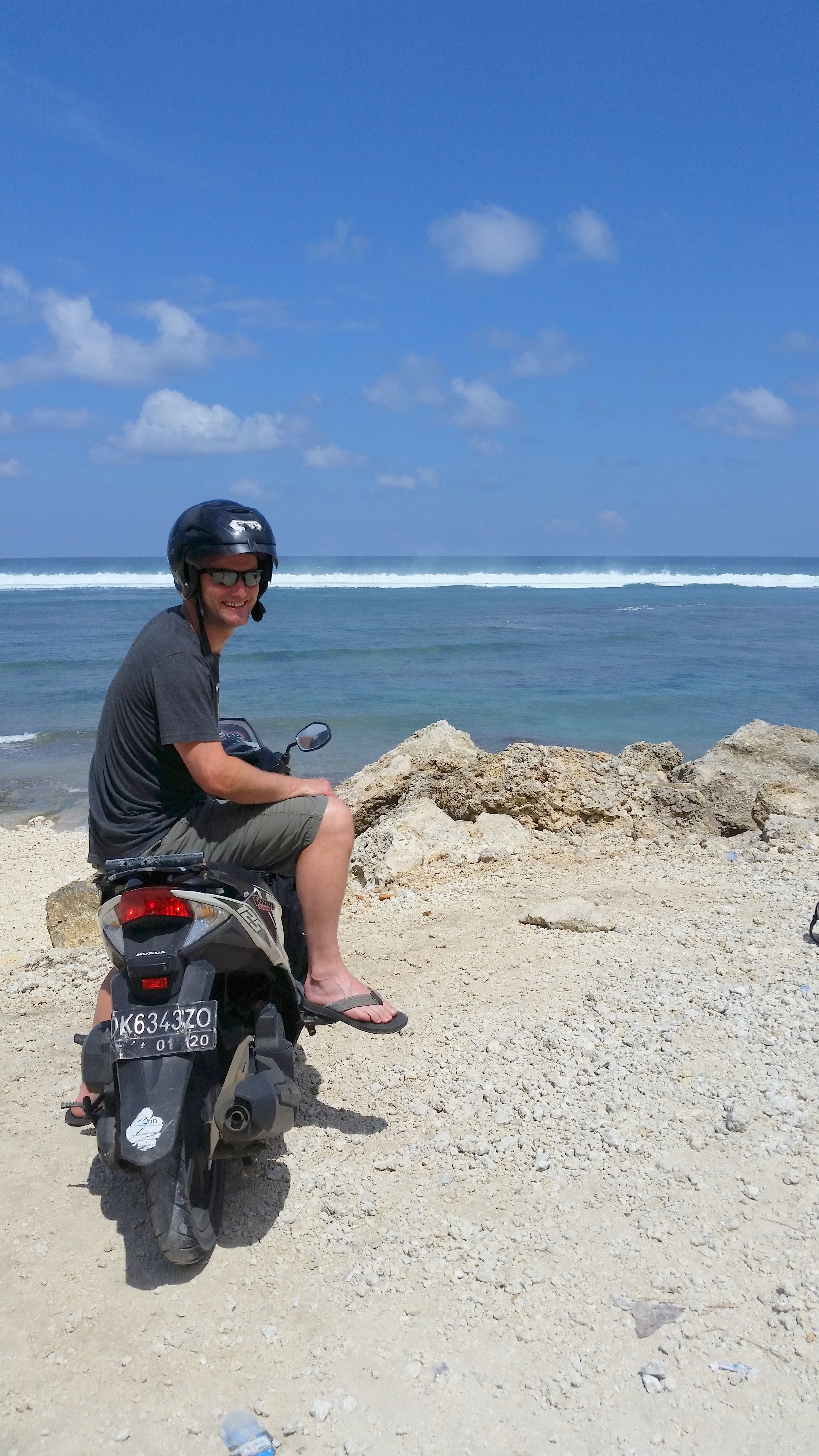
We took off from Yogyakarta Adisucipto International Airport and had a very quick flight to Ngurah Rai International Airport. Once we collected all our bags, we had to organize a taxi to take us to our first destination, the beautiful area of Uluwatu. The taxi was super cheap and before we knew it we had arrived at our homestay (hotel) and it was very close to the beach. A quick bag dump, change of clothes and into another taxi to the beach to chill. What an amazing beach, with some massive waves and current. The locals were very friendly too! A little too friendly at times. 

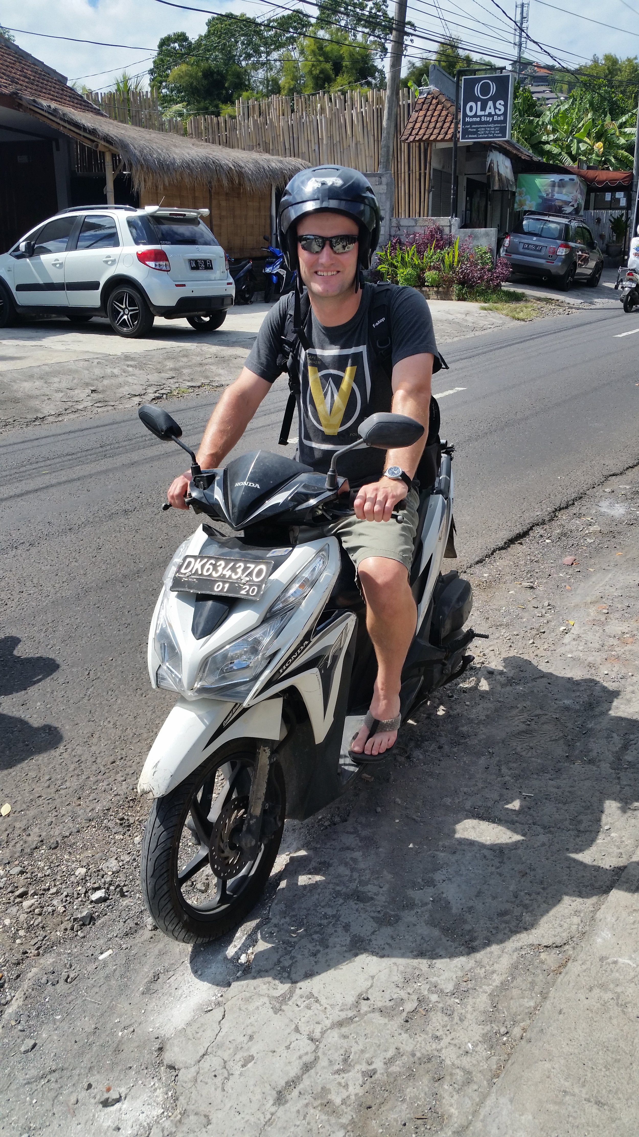
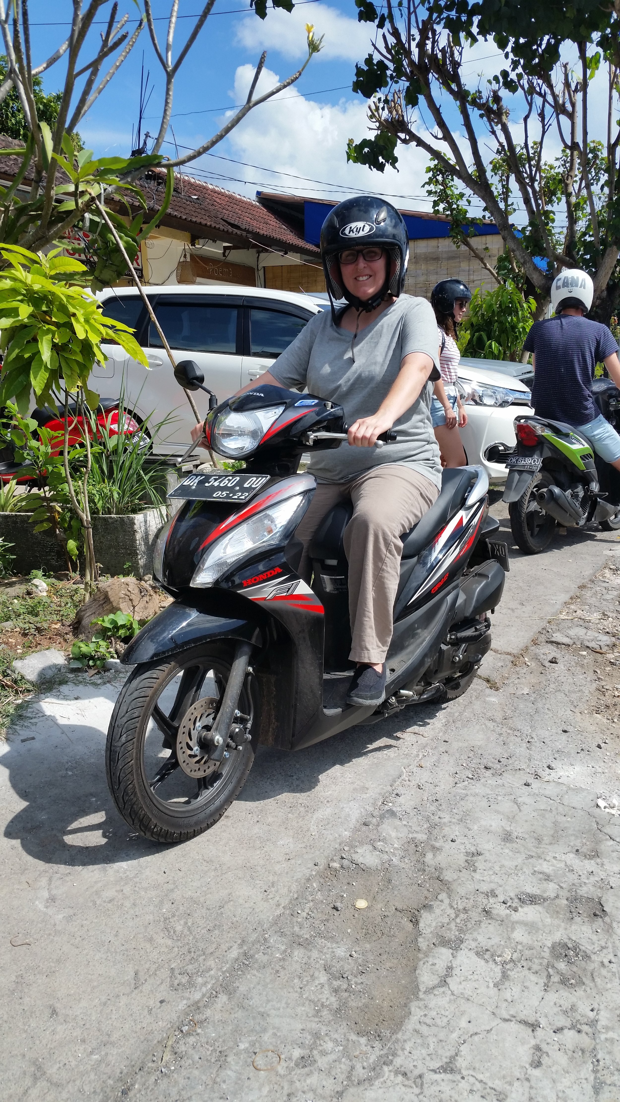
After a great day at the beach day and a good nights rest we all decided to get scooters and do some exploring! 


A great day at a local beach resting up, playing in the surf and eating ice creams! Not too bad. 

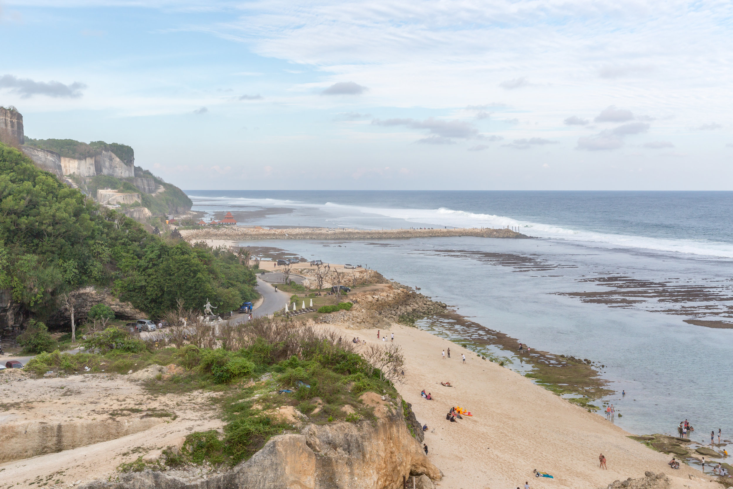
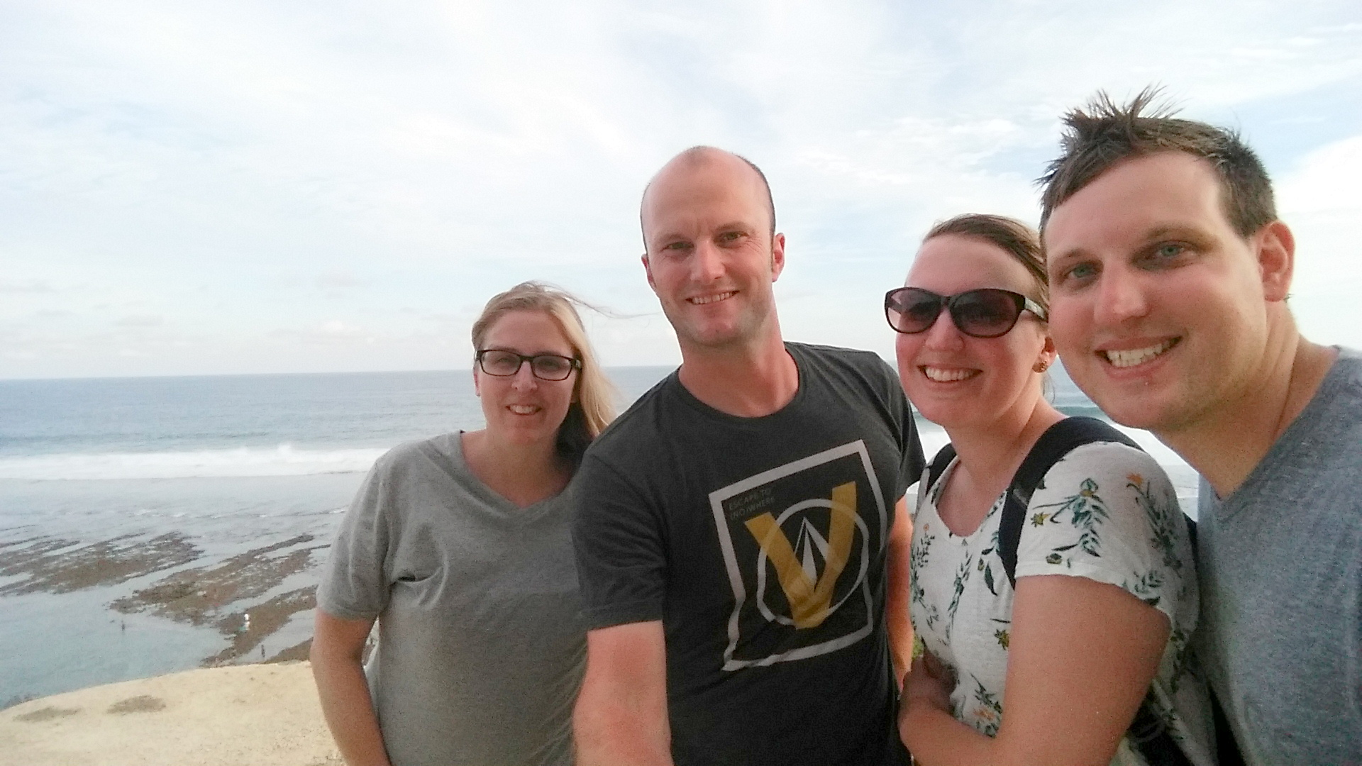
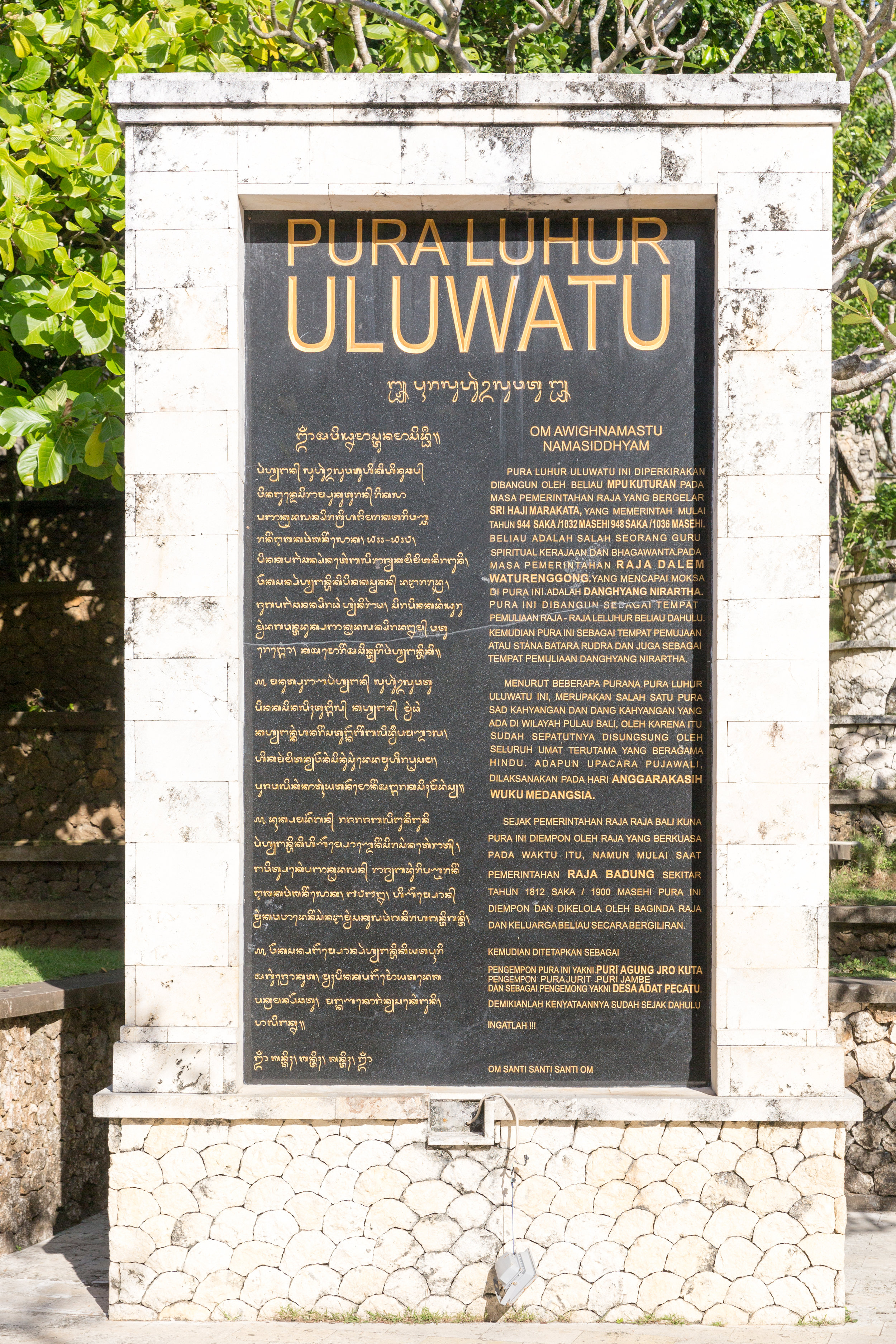
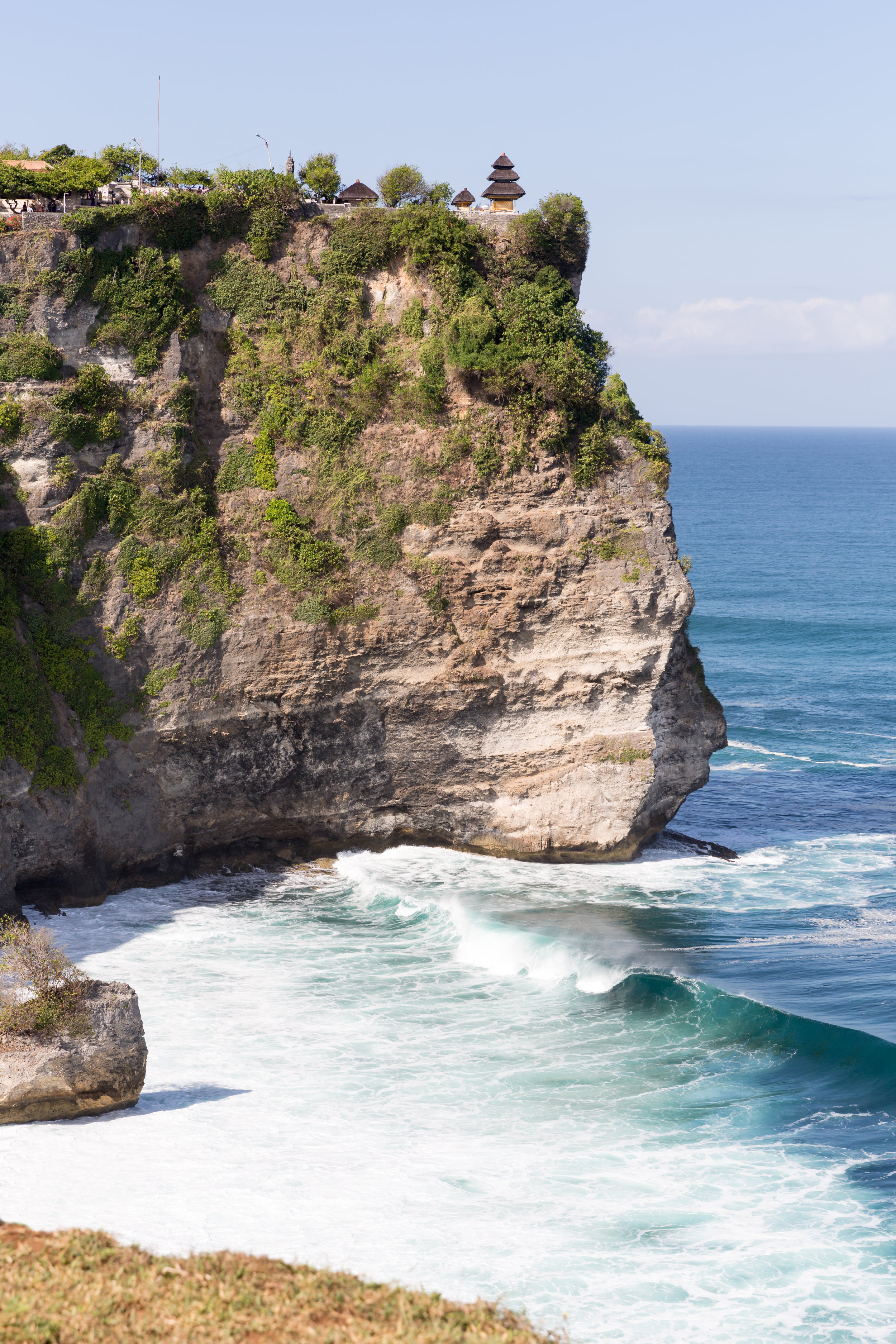
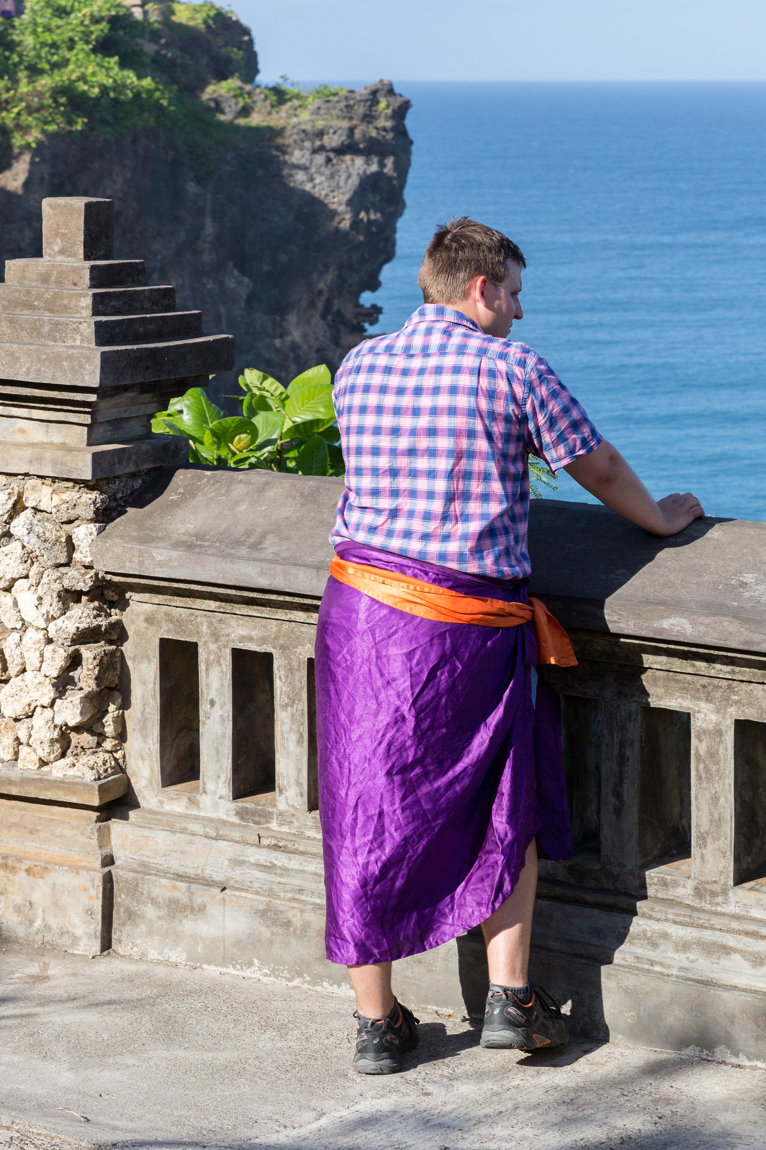
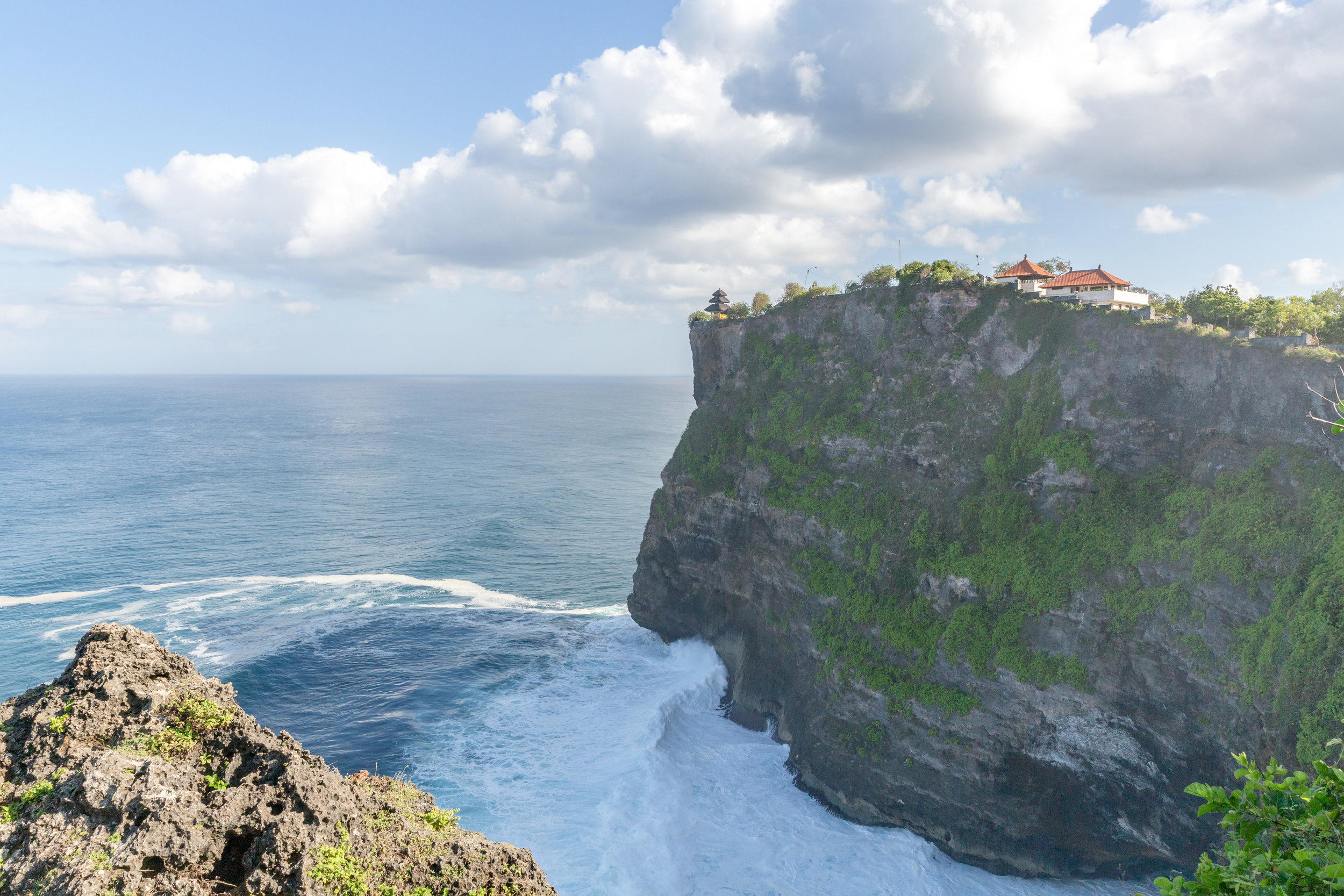
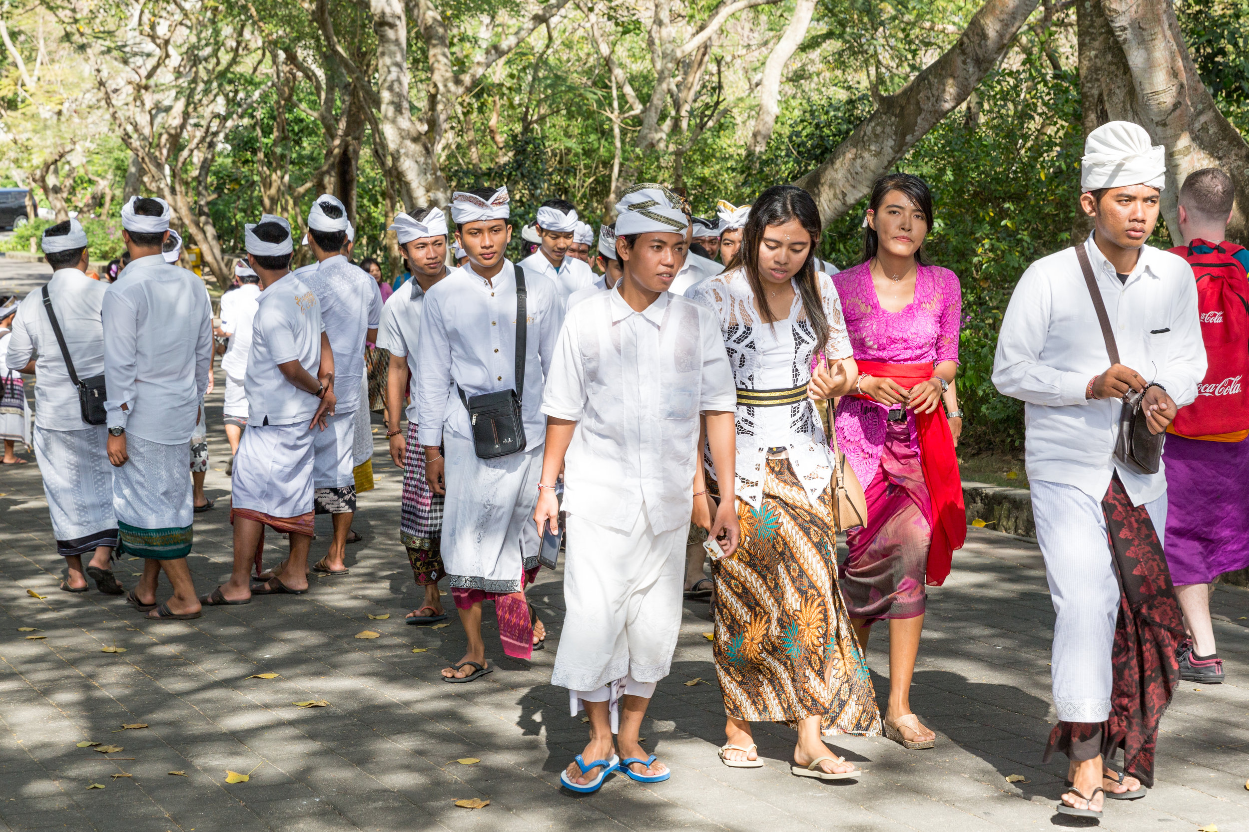
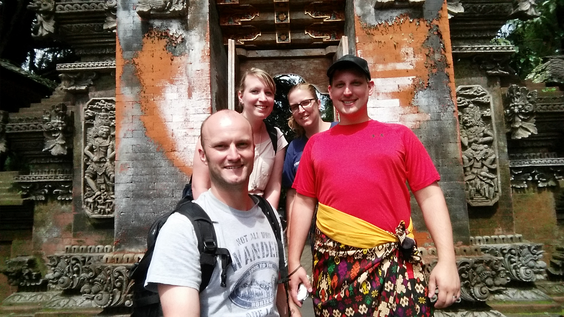
We had the scooters for 24hrs so we got up early the next morning and went to the Uluwatu Temple
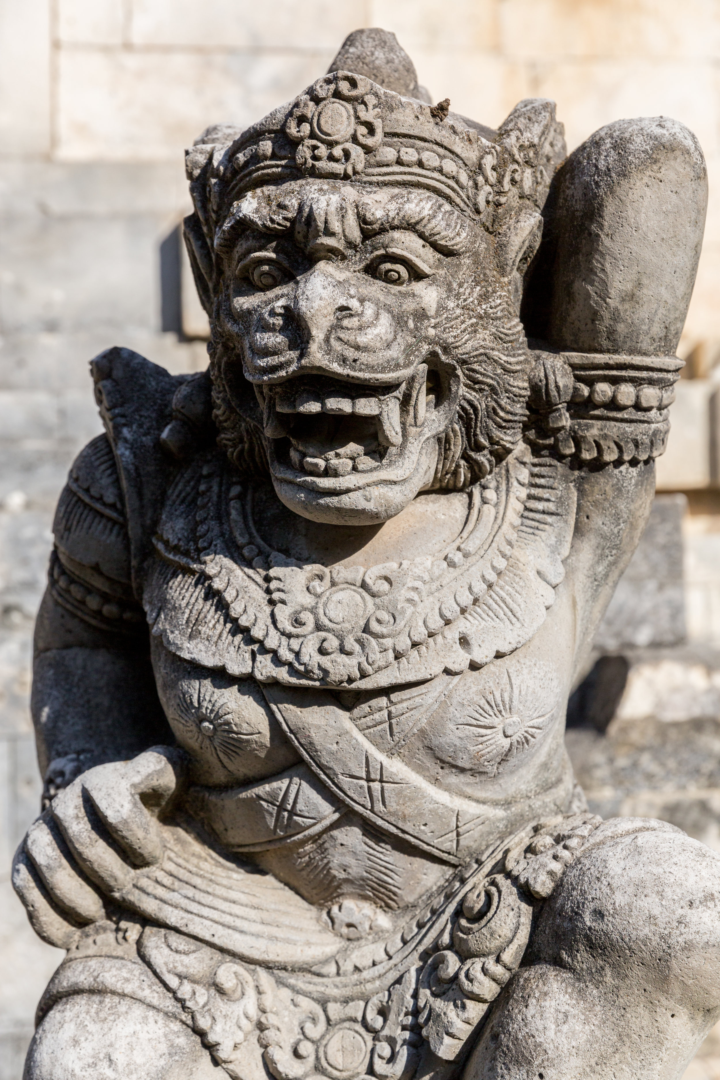
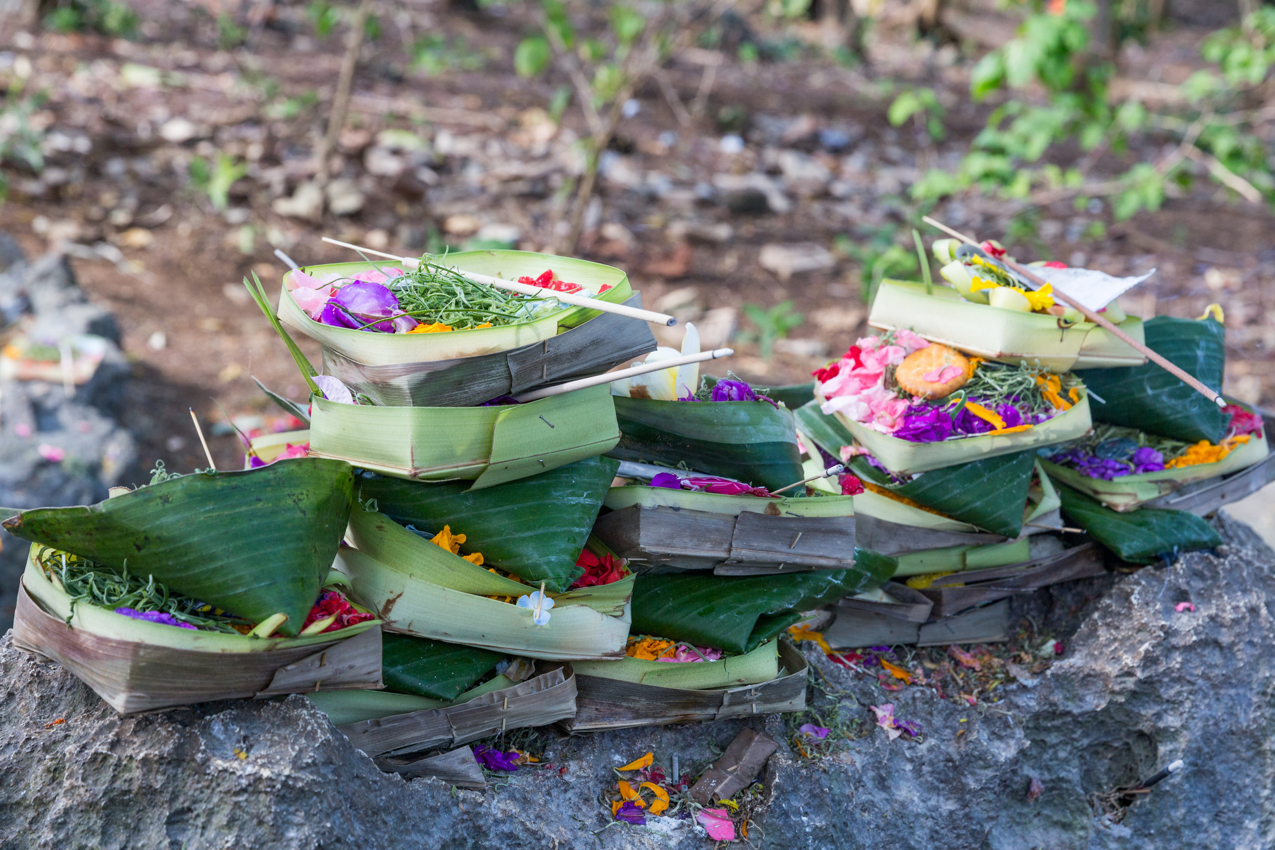
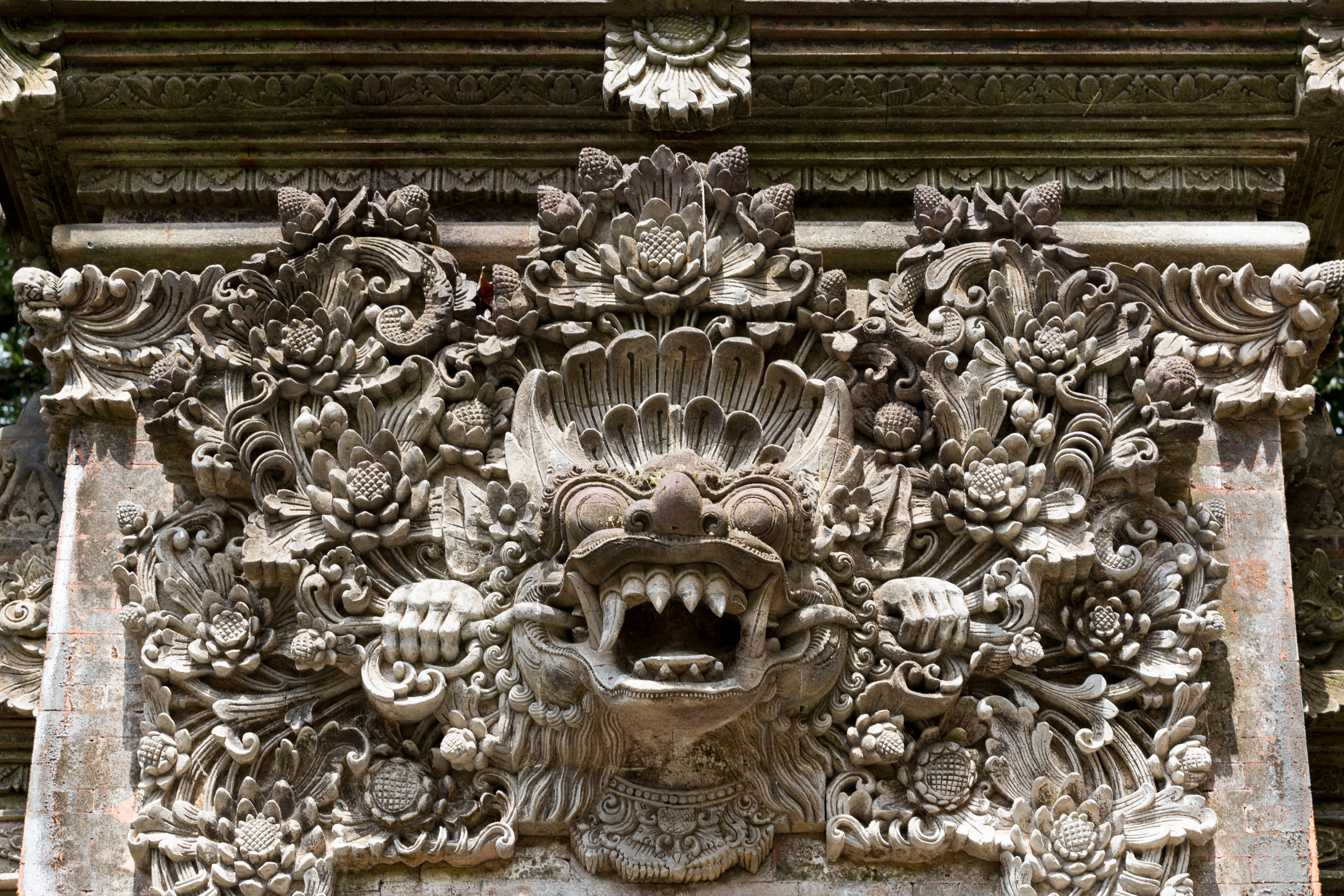
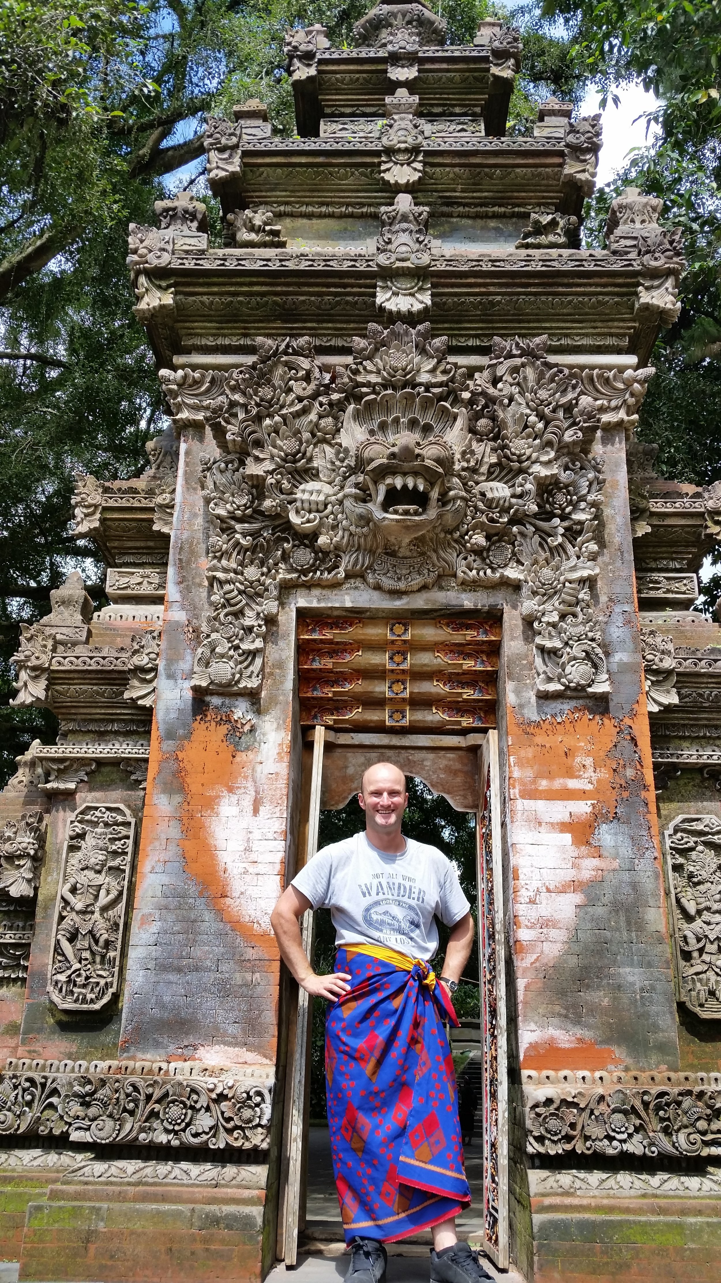
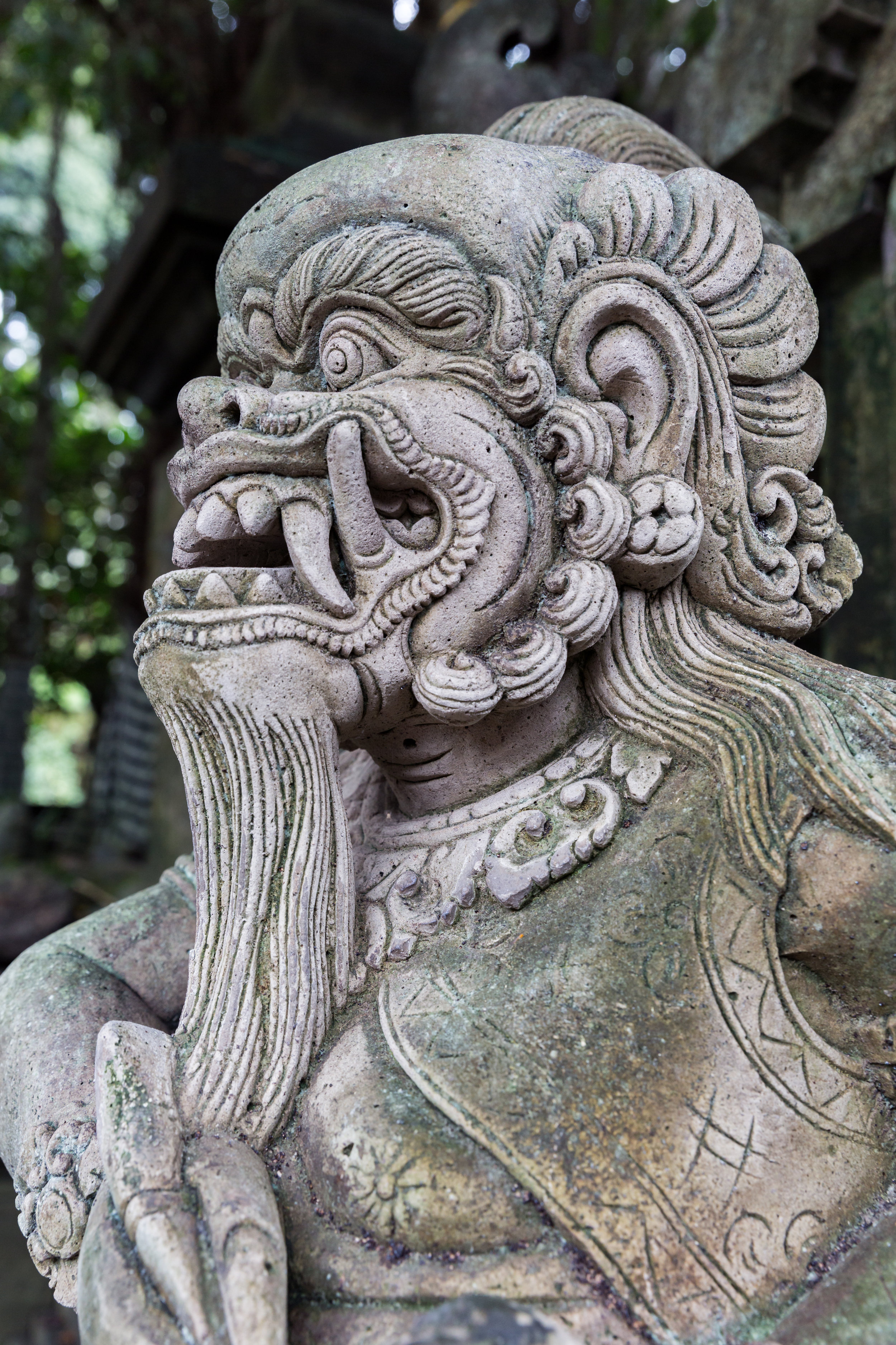
Pura Luhur. This compound is a Hindu temple and is built right on a 70m cliff. The whole compound and all the buildings are very ornate, and getting there early in the morning enabled us to beat the crowds.


Ubud - Monkeys and temples.

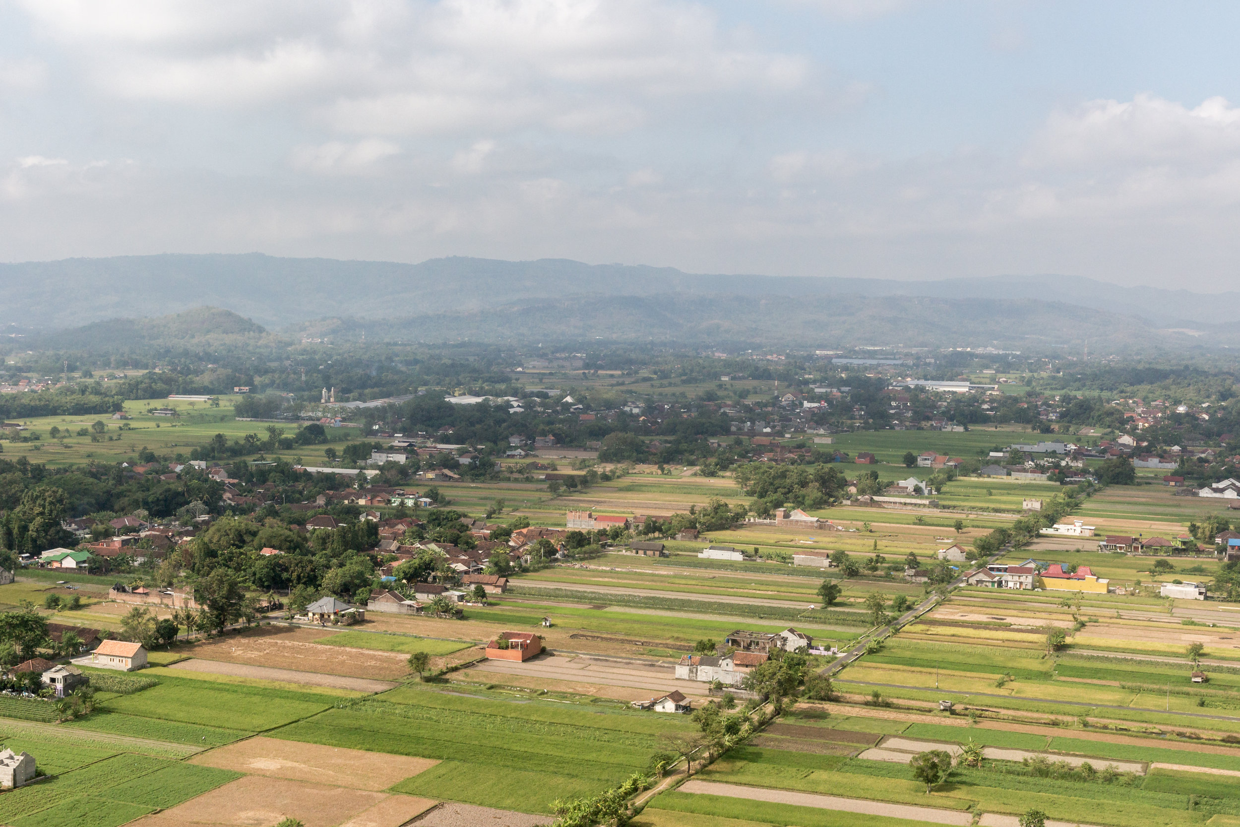
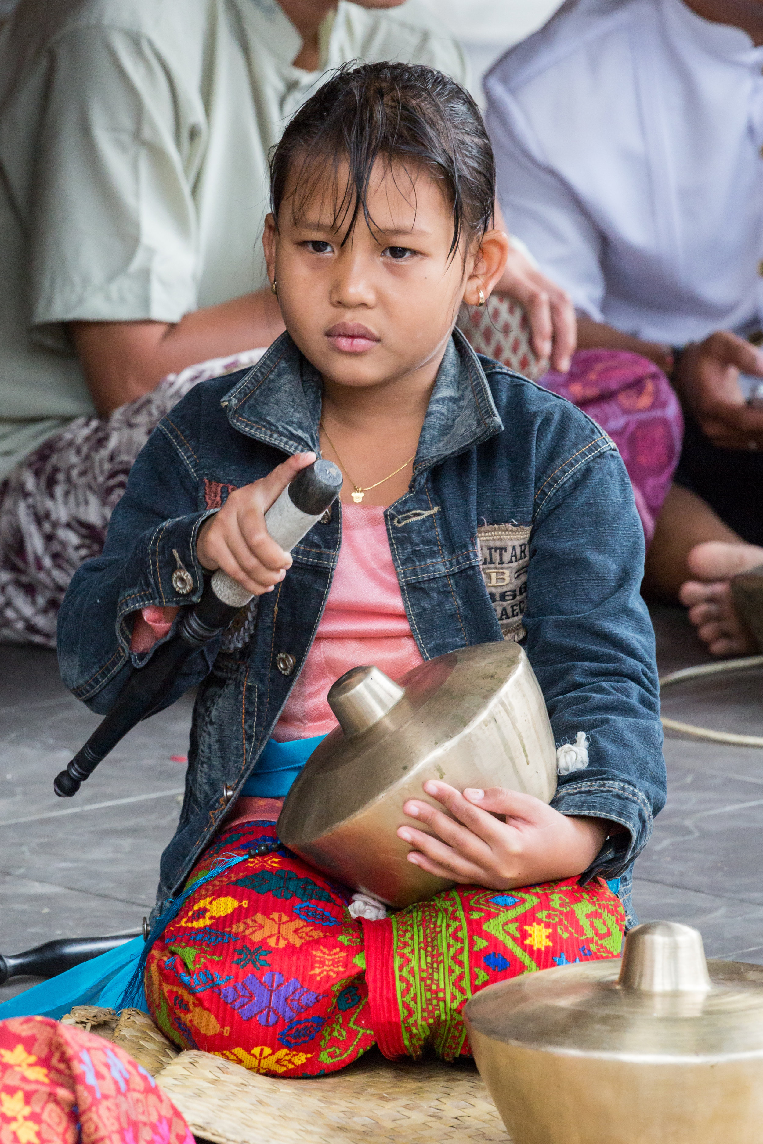
Sadly, this part of the trip was over far too quickly and we soon bundled ourselves into a taxi to go north to the rice fields and open vistas of Ubud. The ride was about 2hrs in a local taxi and it was an interesting endeavor to say the least. The driver was in a rush to get somewhere, and then back again. I think? 

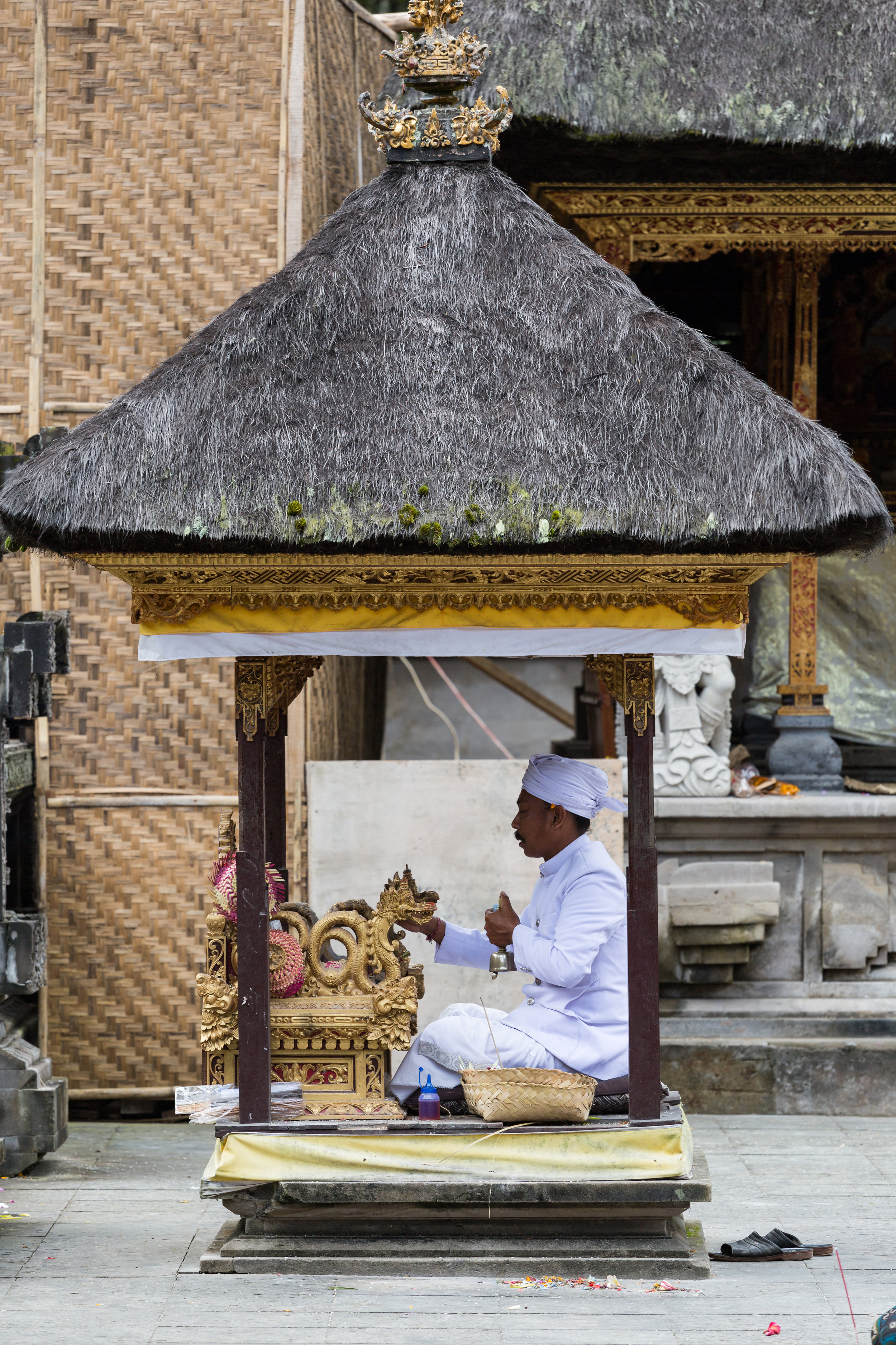
We split into two groups and stayed in separate homestays that were just 15 minutes’ walks from the center of Ubud. The homestay I stayed in with Mandy was a family owned home which had been extended to provide rooms and a pool. The house itself was beautiful and had the families very own temple area, with ornate decorations and statues everywhere. 

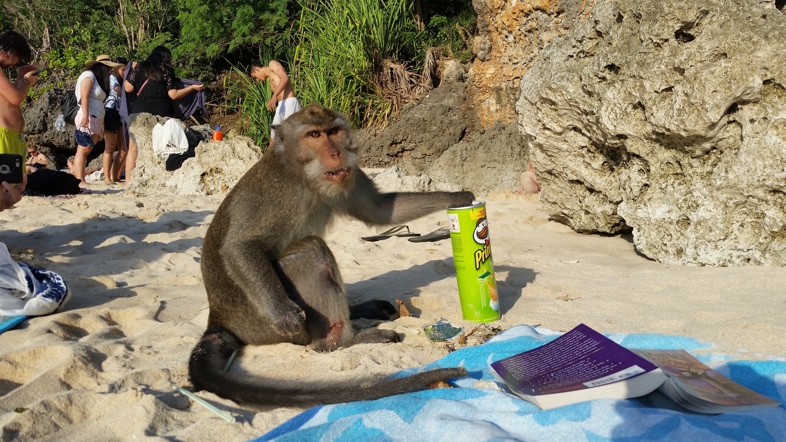
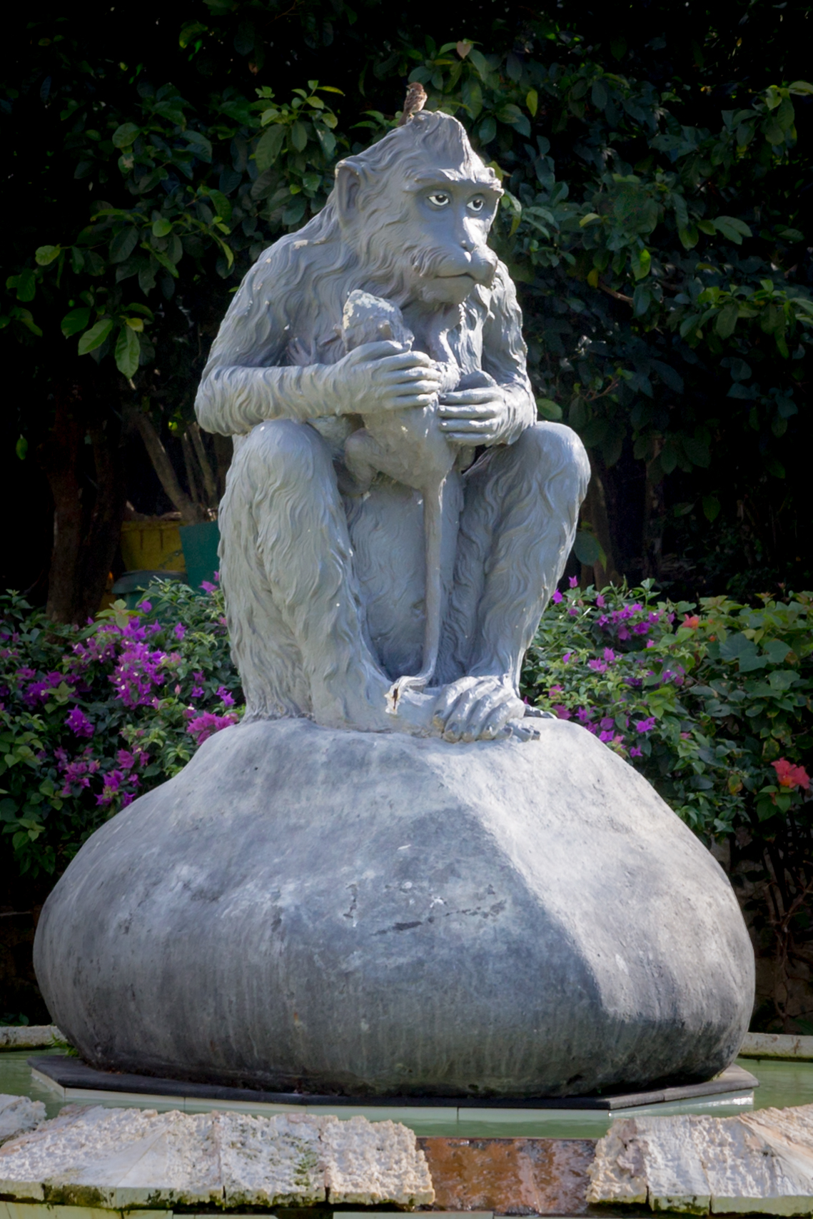
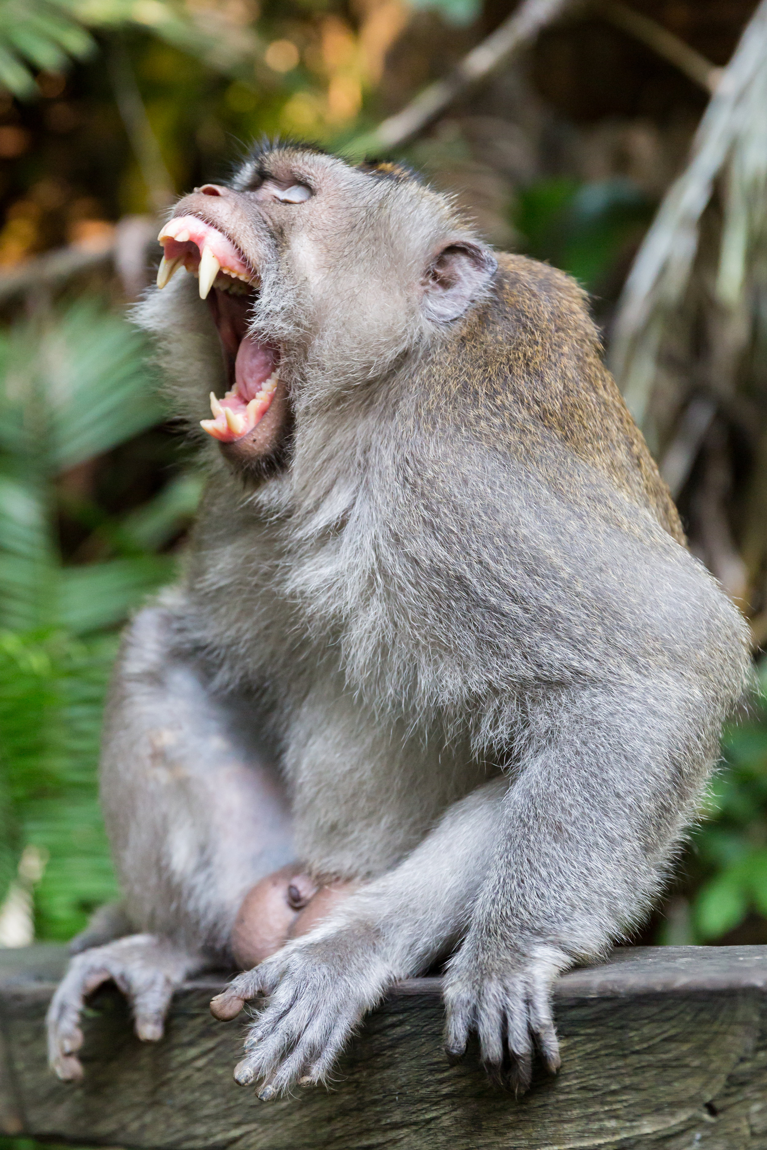
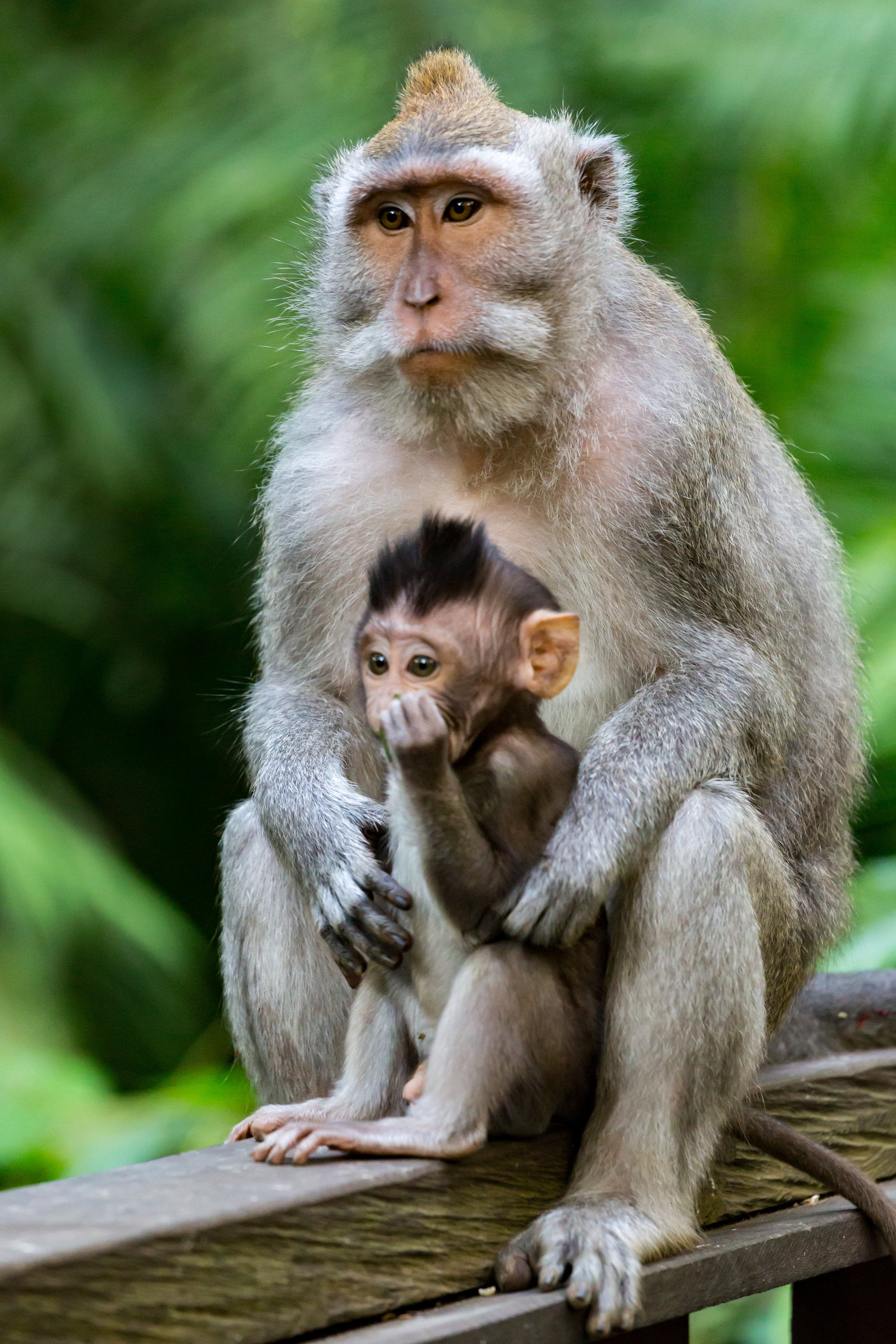
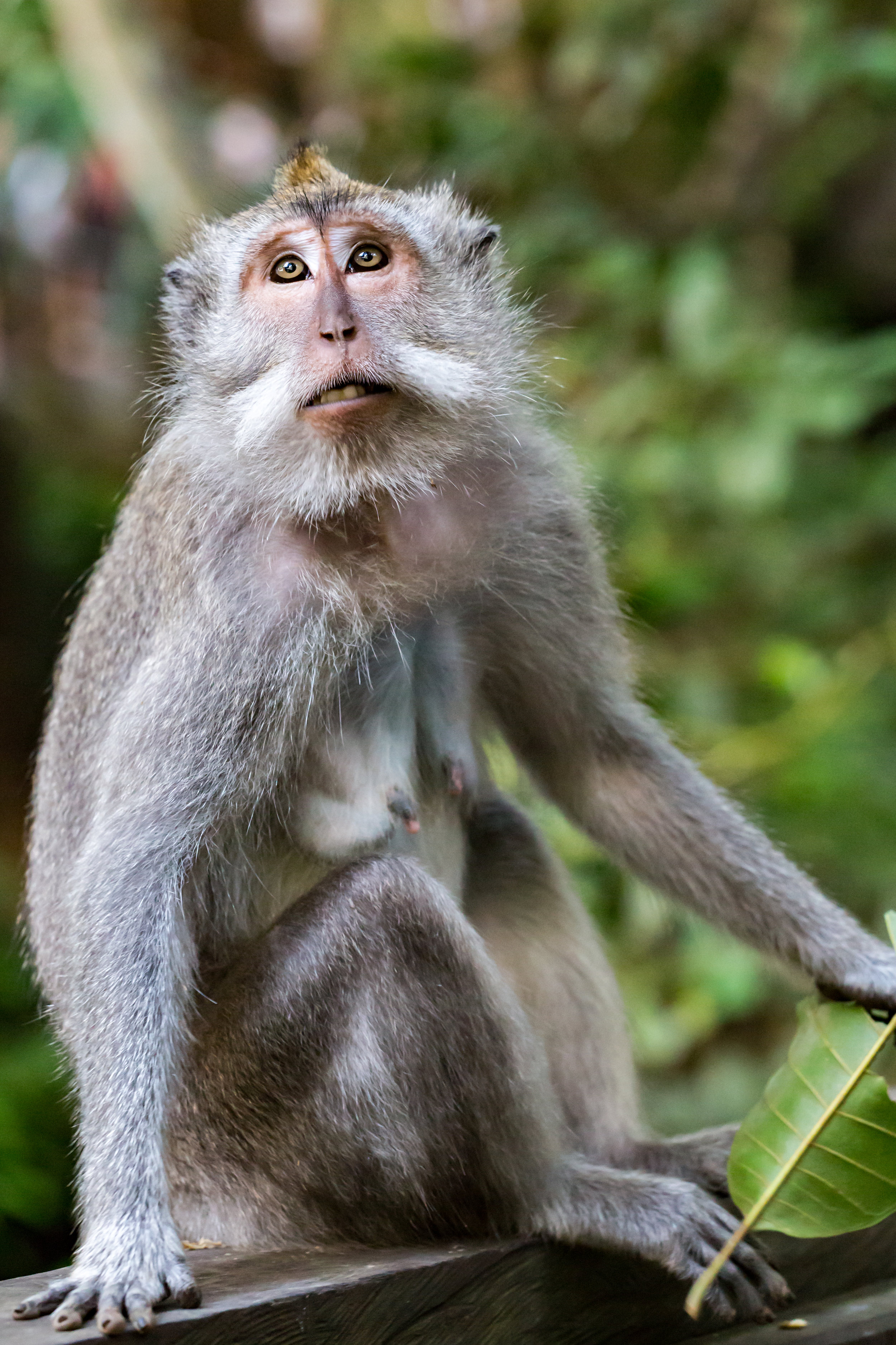
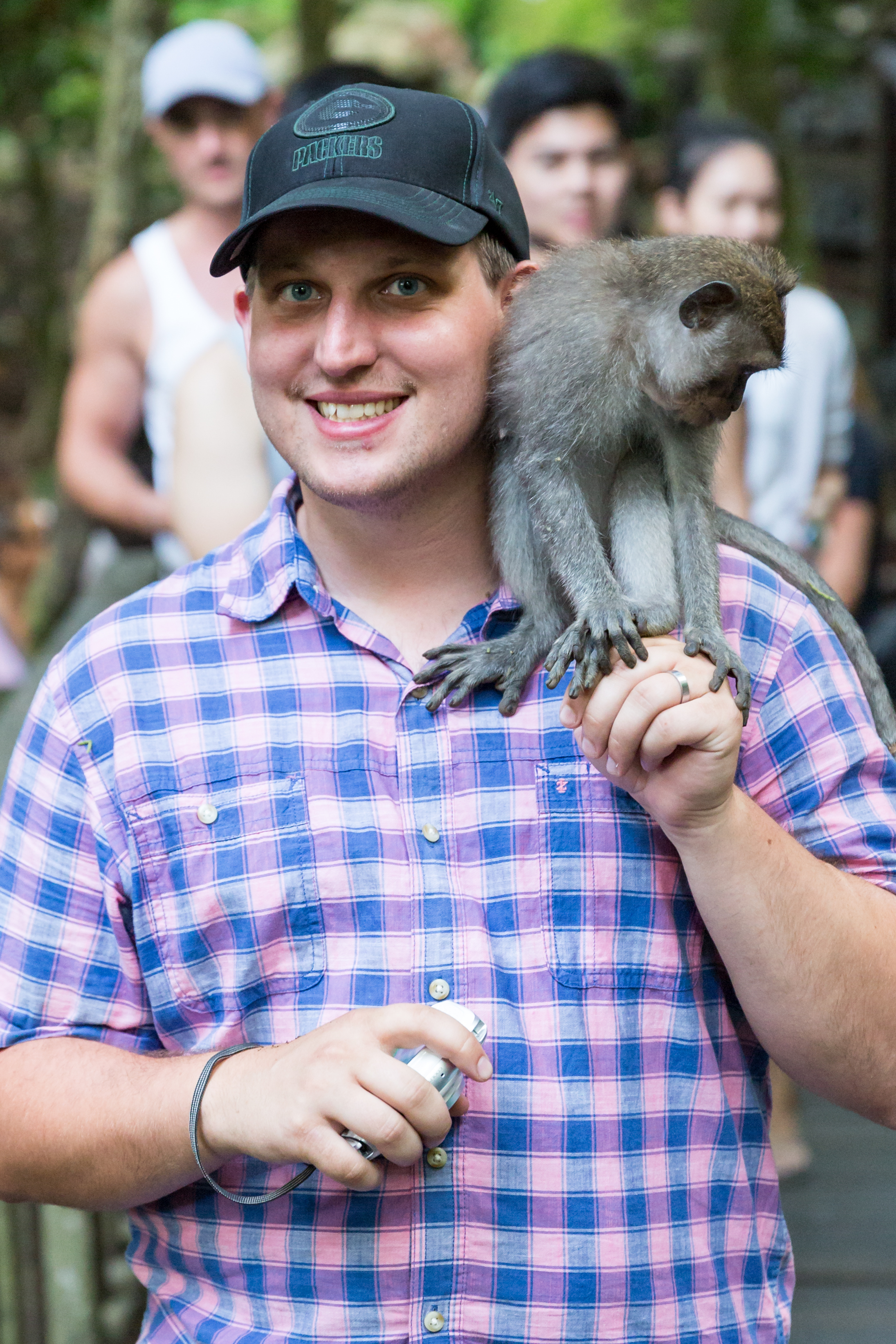
Our first stop after exploring Ubud was the Sacred Monkey Forest at the north end of Ubud. We got there towards early evening and so the light was amazing, and so were the locals.  Most of the locals were long-tailed macaque monkeys. They were very curious and a little too friendly at times, which made the visit that bit more interesting.


This was a whole days’ worth of fun and after a great feed in Ubud we all slept well ready for the last days sightseeing around the Ubud area. 

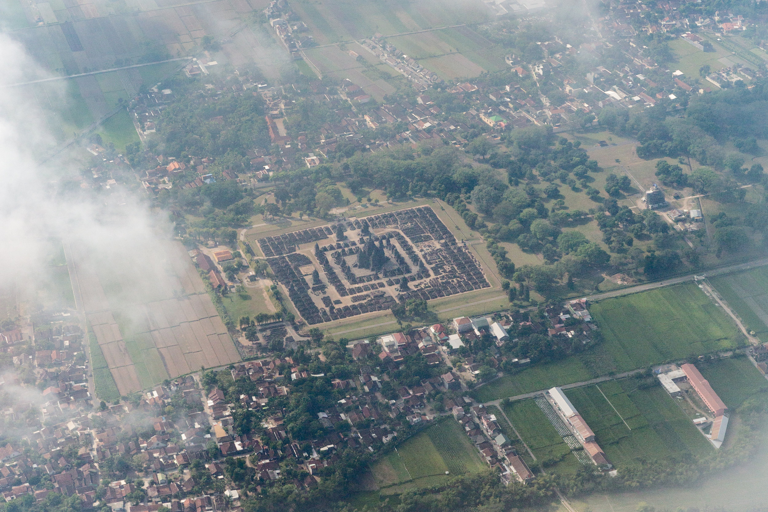
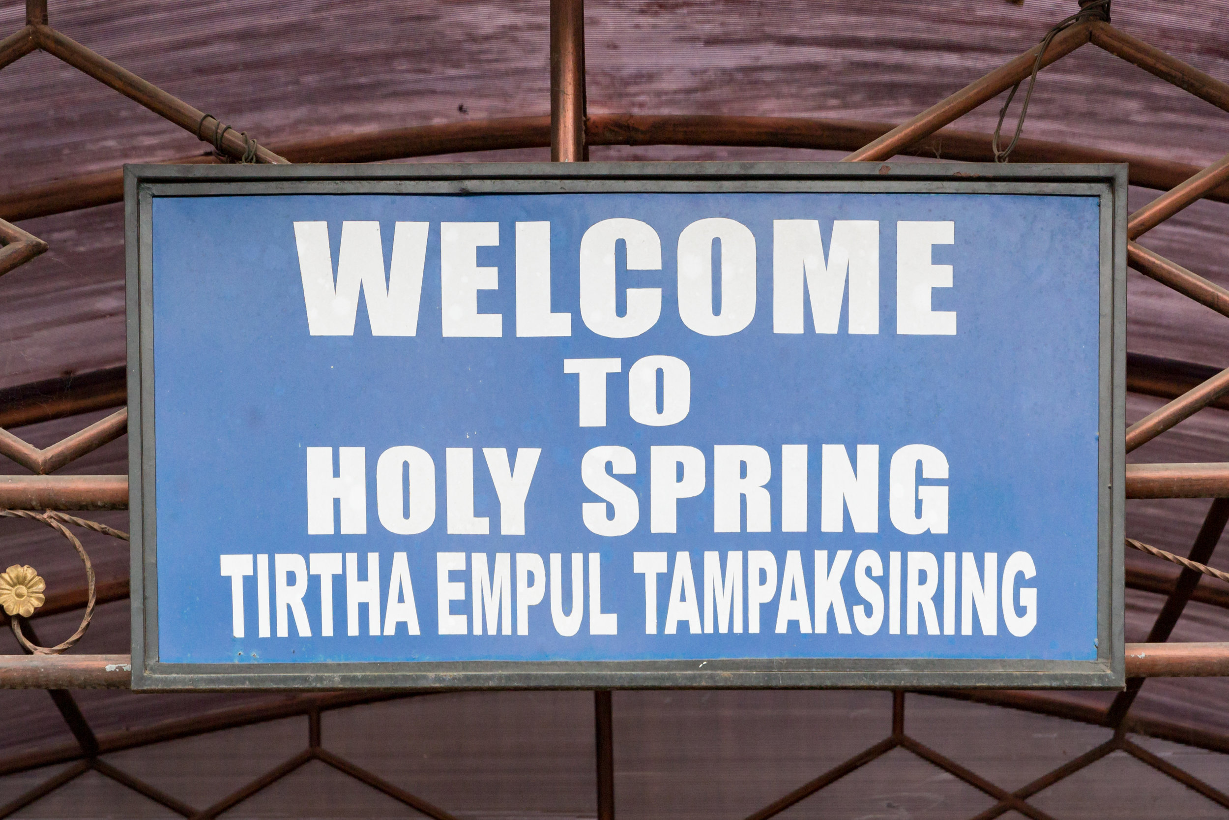
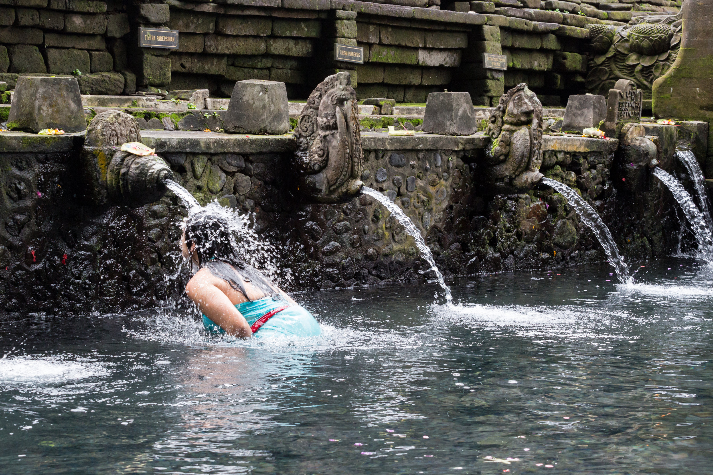
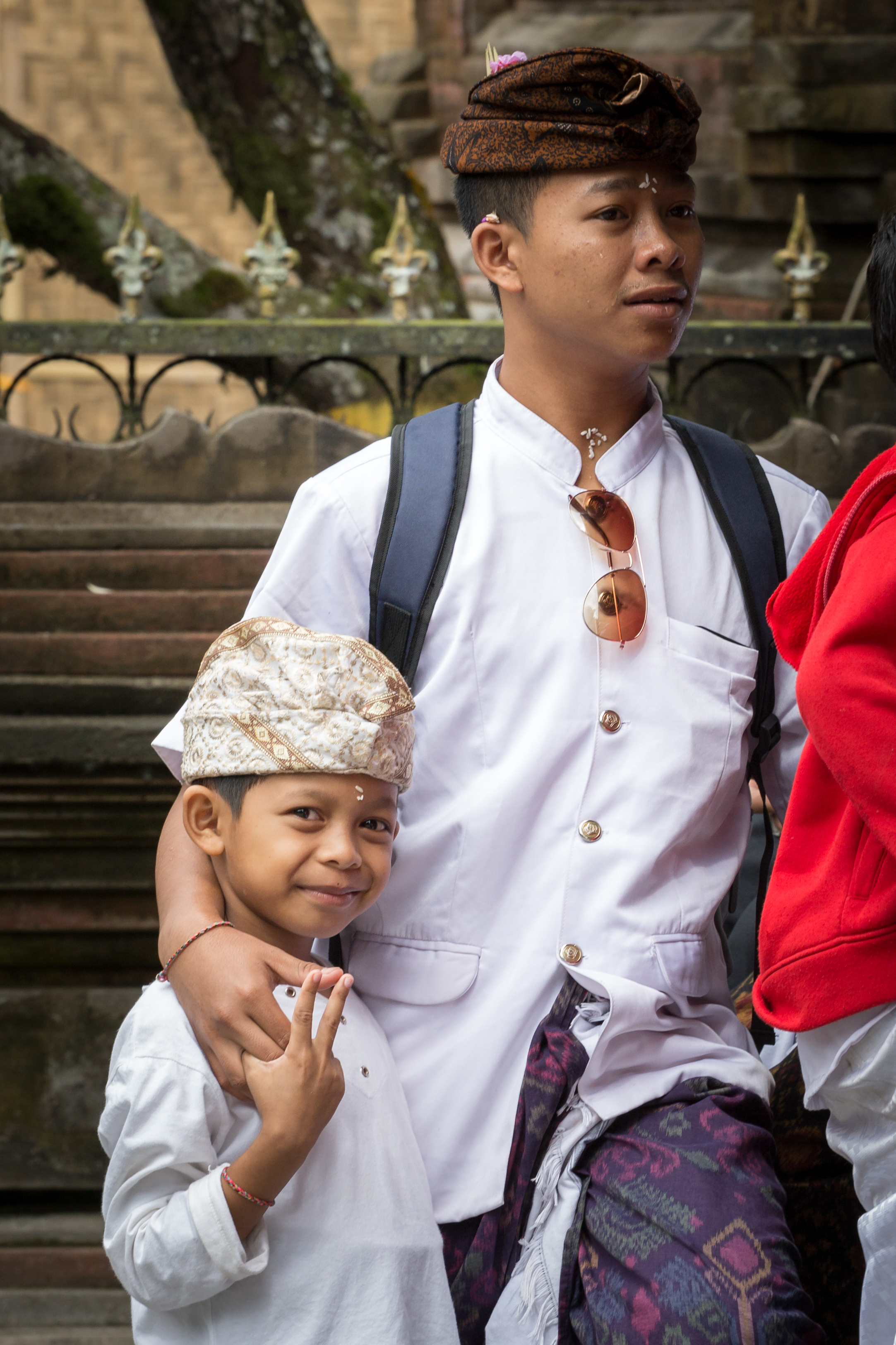
This was to be our last day together as a group so we organized a sightseeing driver for the morning, who would take us to the Hindu water temple, Tirtha Empul Tampaksiring and then to the Tegallalang Rice Terrace. First stop the temple and into another sarong. It was another amazing temple with an air of real history and spiritual importance to the locals. 


After a short taxi ride from the temple we arrived at the rice terrace gardens in the middle of the day. The sun was out in full force, but we still managed to go for a walk around the fields on the hill side, followed by an ice cream. 

Tegallalang Rice Terrace, Ubud.

A farmer preparing his field for the next crop

Rice terraces.

Before we knew another day had passed and it was time to go our separate ways. Mandy was heading back home to DC, Jeremy, and Alissa where heading further north to hike a mountain and I spent the last day chilling in Ubud, and people watching. 

What an amazing three weeks. I met some great people, took some great pictures and had an amazing time. I will work with Habit for Humanity again for all of the experiences and fun that is to be had. 

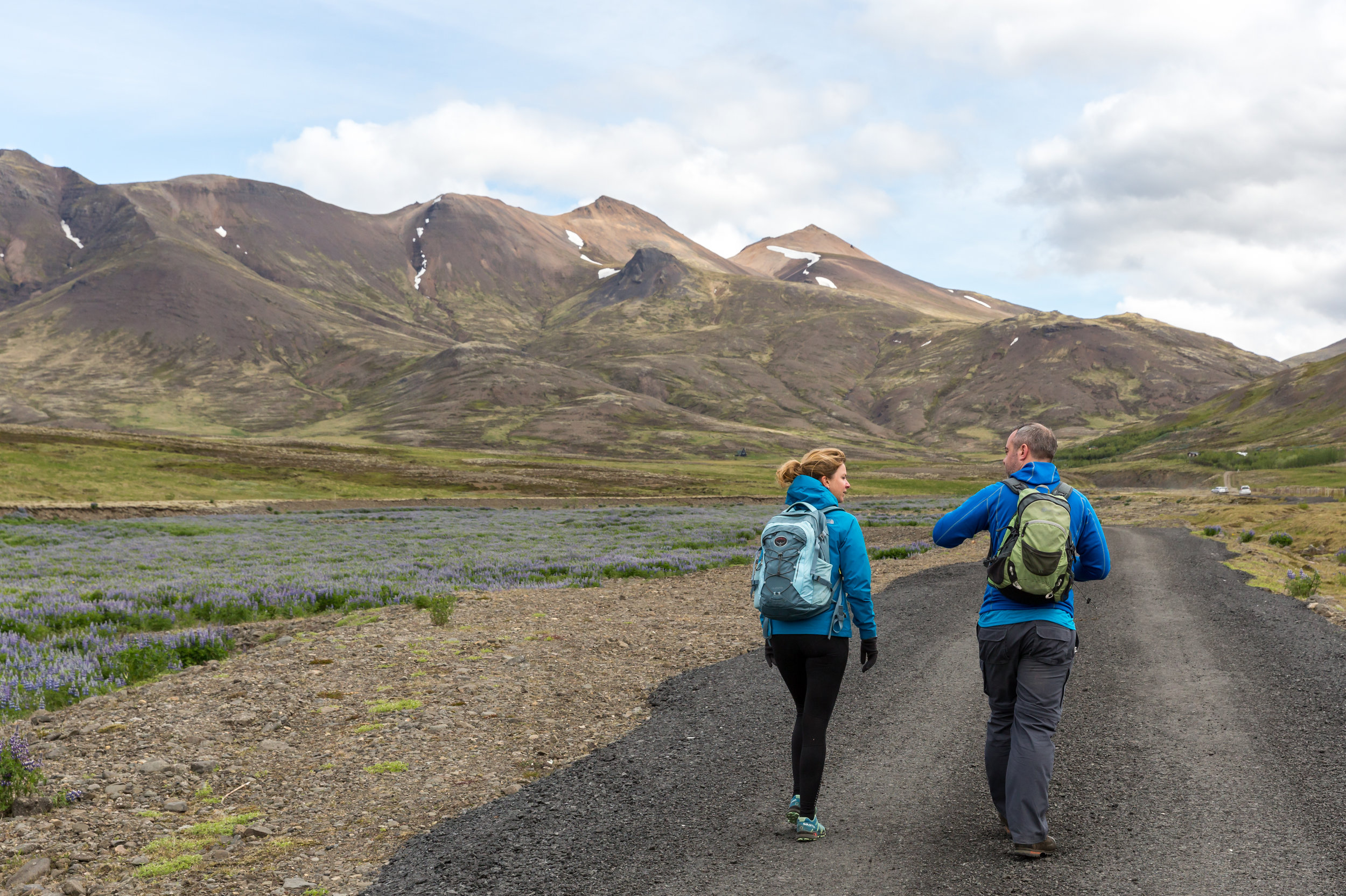
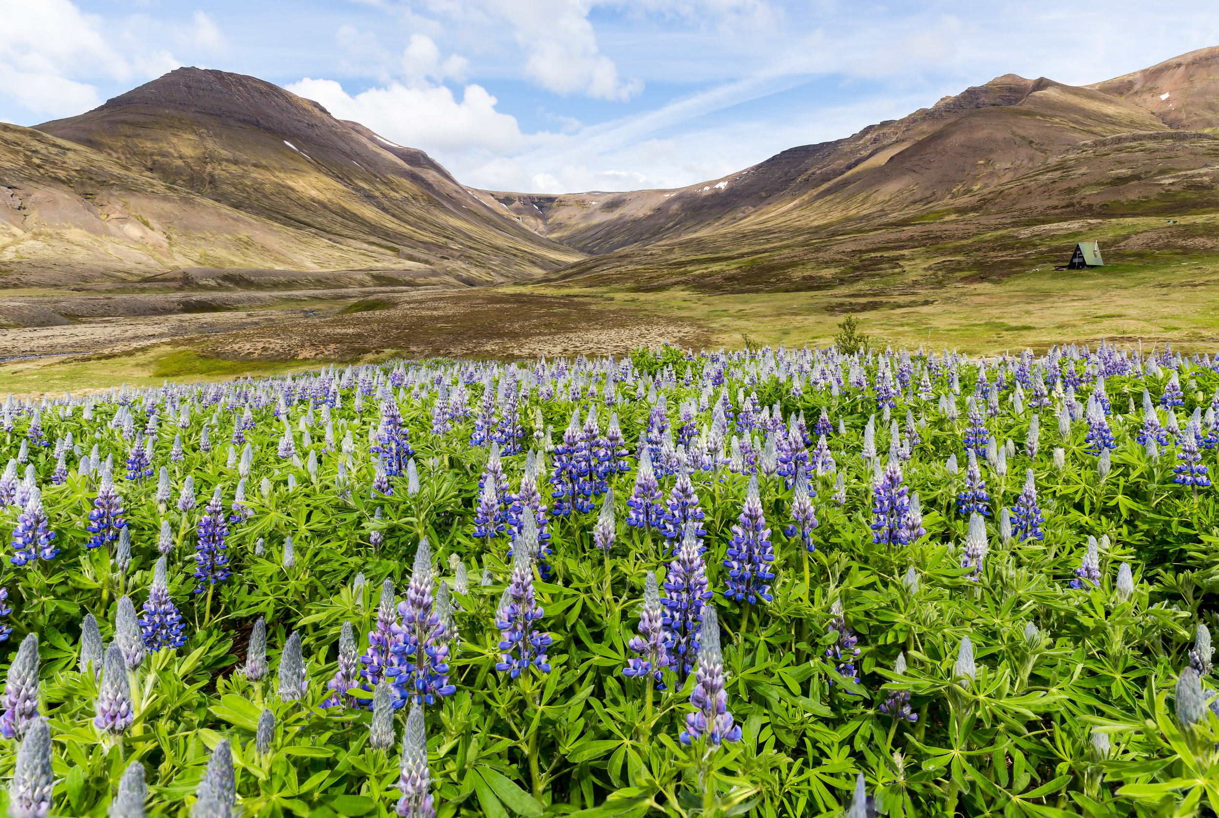
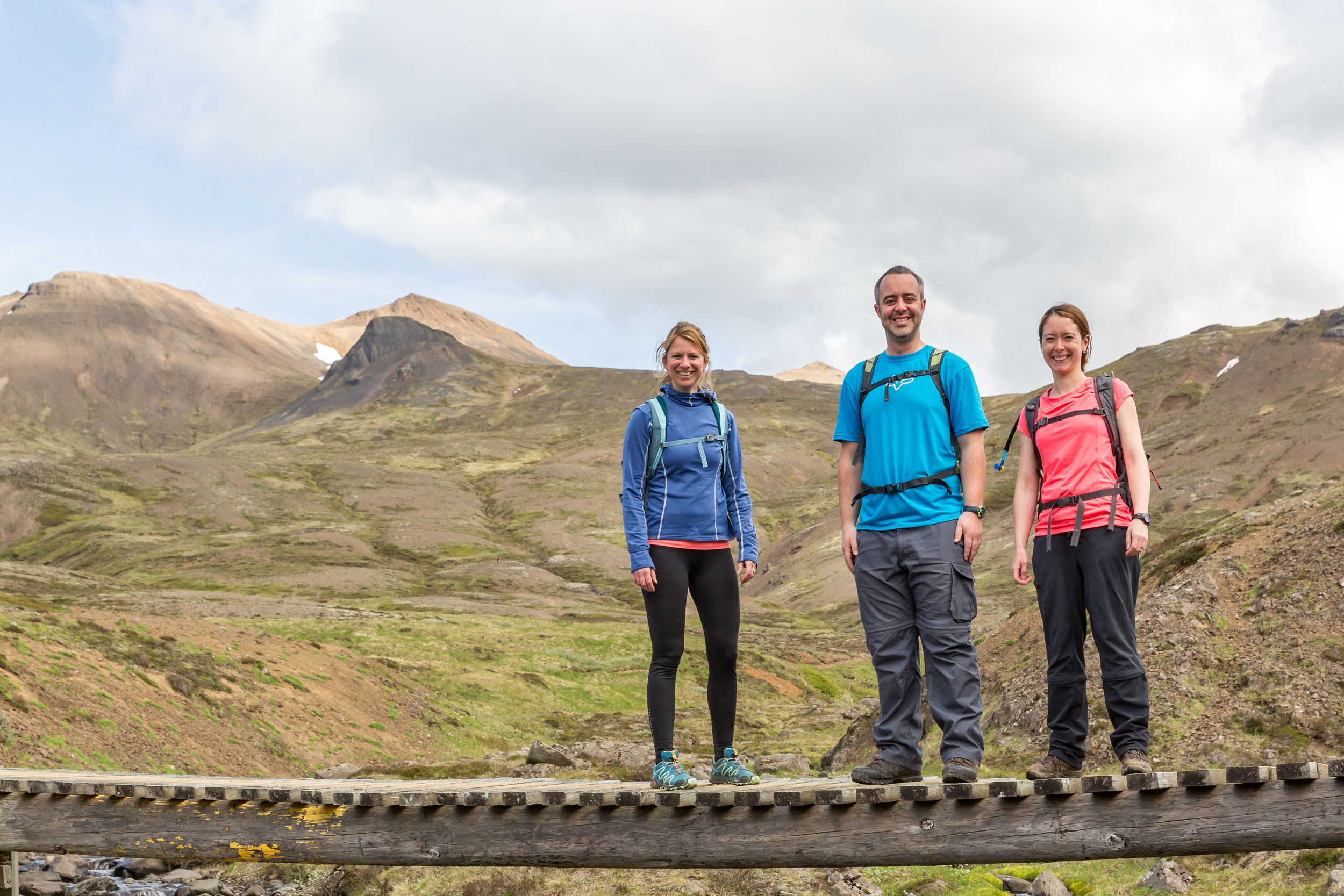
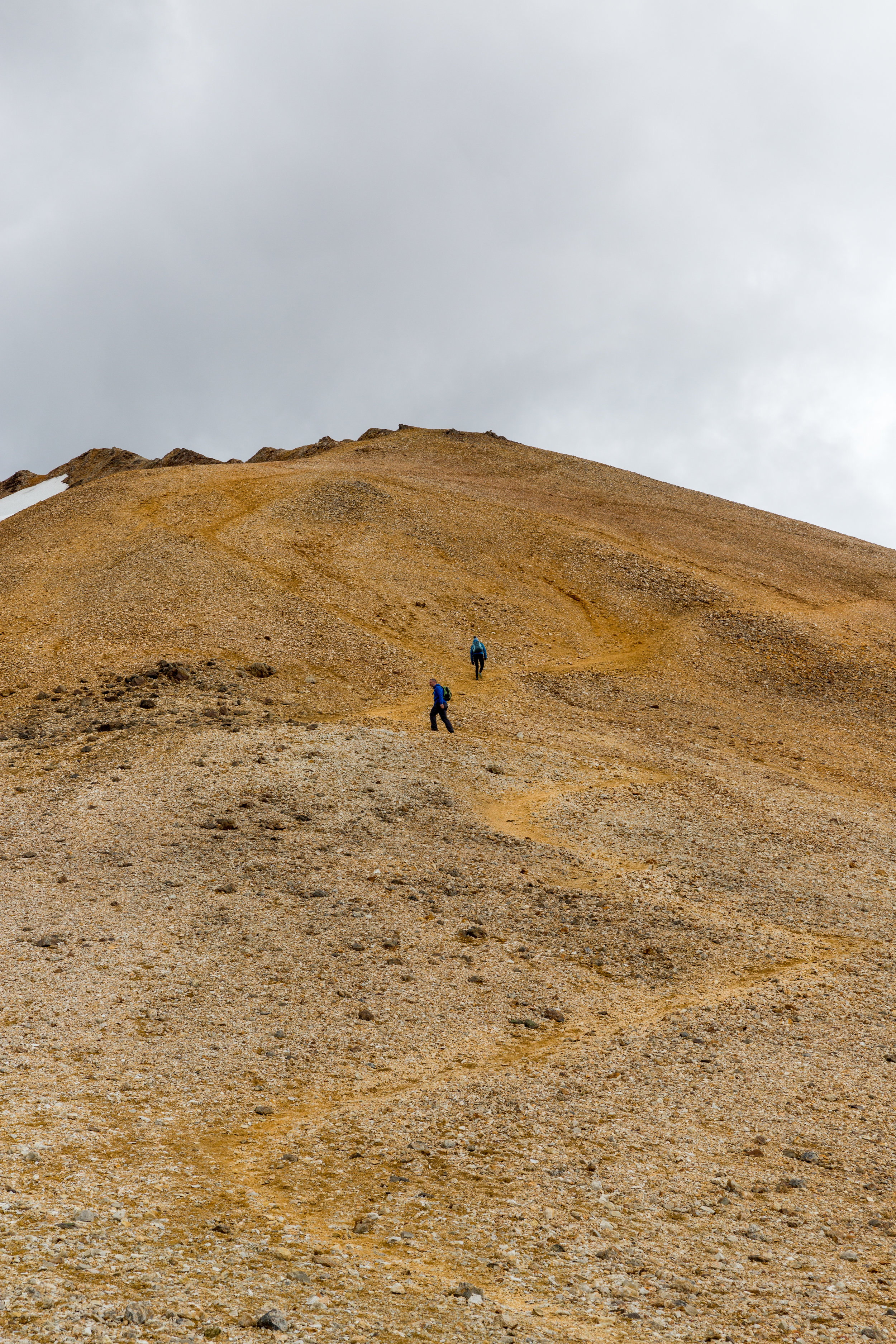
Normal Iceland blogs will now resume as I have a great hiking story to share.

Thanks for reading and come back for more in a week.

Cheers,

Kev

Find and follow my stories on Instagram too!

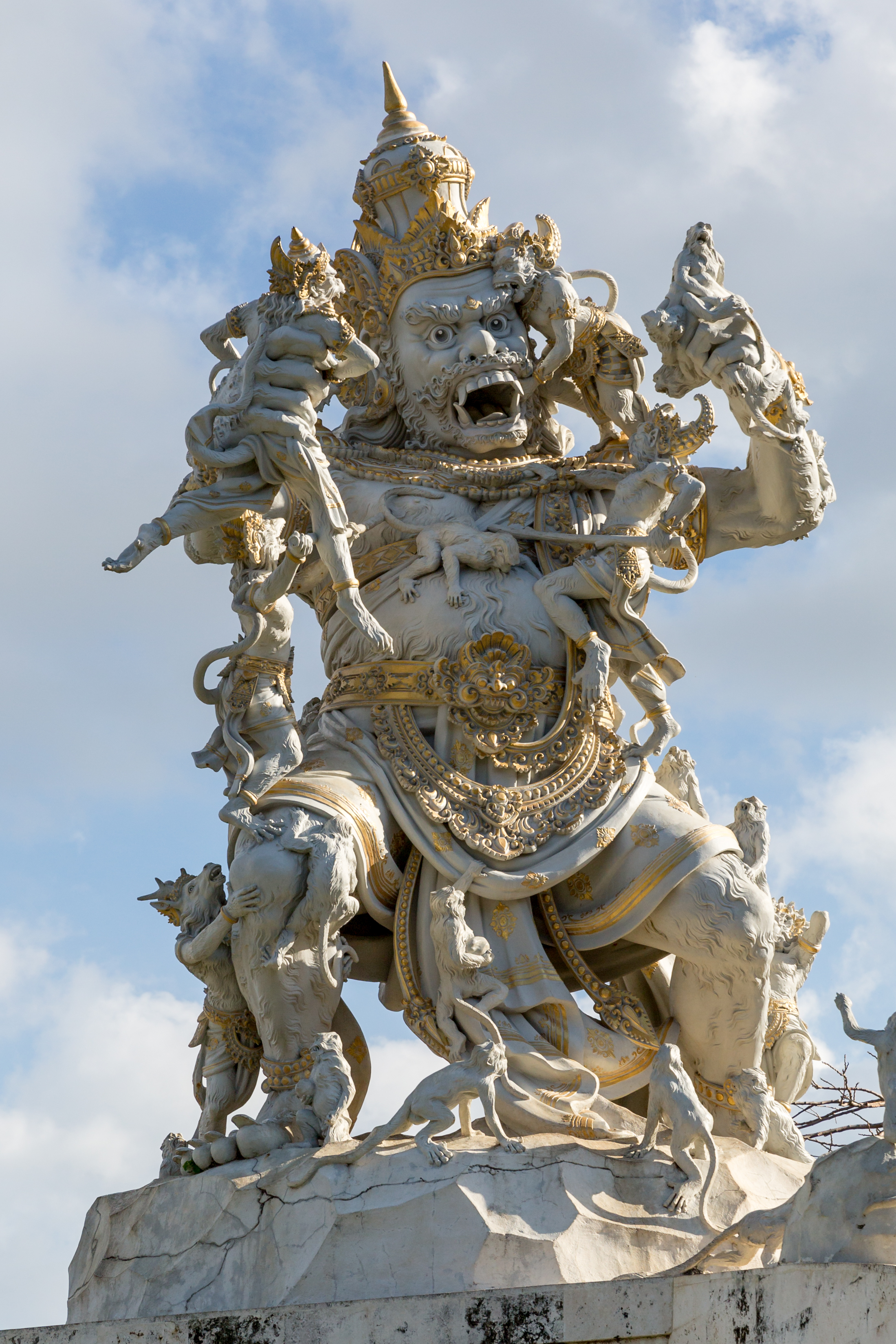
Me and the giant monkey statue at Uluwatu Temple
Pura Luhur.

The build begins - Habitat For Humanity (Part 2) by Kevin Hatcher

Everyone smile.

So, after a very busy and productive introduction to Yogjakarta, I suppose I had should settle in and do some actual work. Time to meet the crew and build a house. To be honest, I was really looking forward to this part, as I have never built anything from the ground up and meeting a whole bunch of new people is always fun!

This was our crew of 14 people!

Back row top left to right: Corrine, Jon, Tanner, Bernie, Jeremy aka Jer-bear, Mackenzie,

Middle row left to right: Mandy (HFH Group leader), Likan, Alissa, Me! Valerie and Jim (Love that T-shirt! Super jealous!) 

Bottom row left to right: Kay and Joyce. The hardest working people on the team! 

We were picked up by our Habitat for Humanity liaison team; Djingga Djiwa and Nofi Fuanda. Djingga worked tirelessly all day with us to help make our stay in Yogyakarta more enjoyable. He picked us up in the morning, drove us around, organized dinners during the week for all of 16 of us, and put up with all of our nonsense! No wonder he slept in the work vehicles so much. We also had the amazingly happy and friendly, Nofi Fuanda and her impressively large and colorful collection of hijabs. I don't think I ever saw two the same for the whole build project! Impressive! 

Thanks for the pick Likan. :)

Thanks for the pick Likan. :)

The daily commute.

After introductions and photos at HFH Indonesia HQ we were driven about 1 hour south to Selopamioro village in the Imogiri Sub District. 


Puji Raharjo with the sharpest knife I have ever seen. We never got to do this in case we lost a finger...right Corrine. 

We were split into two teams at the site and introduced to our site foreman who would look after the running of our house build.

Ladies and gentlemen...our foreman Puji Raharjo!

He would be in charge of us, instruct us on how to use tools, keep us safe (no mean feat) and helped us build our house. Oh, and he cut up and fed us fresh coconuts!

Awesome! 


Some of the children and a few from the local village.

The family, mother and father. They have 3 children too.

The family, mother and father. They have 3 children too.

We were then introduced to the family that would move into the new house. They were so friendly and accepting, it was amazing. In fact, the whole local village was, and it was all very humbling. 

Our house was a 3 week build and we would be working on it for 2 weeks to get as much done as possible. 

Right let's get started!

The build plan.

So, if like me, you have never built a house here is what you need to do:

  • Move all the material (boulders, bricks, grit/sand) to site.
  • Hand dig foundations.
  • Shovel through a large sift all of the grit/sand for concrete.
  • Make concrete.
  • Lay foundations.
  • Build walls.
  • Make and install reinforcing bar (Rebar) columns and layers whilst building walls.
  • Install windows.
  • Build joists and install roof.
  • Lay floor. 
  • Move in.

Well that is a bit simplified, but you get the idea and all this is done by hand. There was no machinery involved during our build. 

The first few days of the build. 

Now the first few days we dug foundations, moved material and laid the first foundation stones. We were also very lucky to have the neighbors help too. When we left for the day they would pick up where we left off and continue. That meant our build came together very quick. It was great! 

One of the greatest things was how happy, friendly and inquisitive the local kids were. It made working in the baking sun all worth it. 

During the third day I met the one pictured below on the right. His name...Kevin...What a great name! But I never could get him to smile in photos.

Kev on the right....Kev on the left and Riza in the middle. Both not looking impressed.

The other major part of this particular build was reinforcement bar (Rebar). It is long pieces of metal that had to be hand cut to exact sizes, and then bent and then wired tied to the beam/column for the house. It was a long process but a great way to chat to the guys and get to know people. 


During all of this rebar making our blue tarp/tent (it was just like being in a U.S. campground) that shielded us from the sun collapsed in the wind. So in true "get your hands" dirty fashion we helped to fix the tarp, and held up ladders and supports until the locals fixed it. Then it was straight back to making rebar.

No rest for the wicked!

In the first week the house made great progress, and we completed: digging the foundations, constructing foundation walls, started to build the house walls on the foundation and made some great friends with the locals and each other. 

The weekend arrives.

So after a very productive and busy few days it is the weekend and we all have time to relax, and do some site seeing around the wonderful Yogjakarta area. What better way to do this but to return to Borobudur to see if we could all see the sunrise! 

After a really early start, and along bus drive we all arrived in the dark to climb the stairs of this amazingly peaceful temple to wait the sunrise. There was a slight sunrise which was cool, but I also got more time to explore the temple afterwards, which gave me a real appreciation of the intricacy and detail that went into building the world's largest Buddhist temple.  

Borobudur Buddhist Temple just at sunrise.

After such an early cultural start it could only be topped off with thrashing around in a jeep around Merapi to see the remains of the last volcanic eruption. The jeeps where great fun, and we all had a blast! 

What a week! I took it easy on Sunday while others explored the city center. Next Indonesian blog update, we continue building the house, we get invited to a local wedding, we explore a cave and we have an emotional good bye ceremony with the family and all the HFH team. 

Come back for more! 

Cheers,

Kev

Find and follow my stories on Instagram too!


Weekend tripping around the south and Reykjavik by Kevin Hatcher

How do you top going to the Westfjords? Well, it is difficult, but there is always something new to look at in Iceland and a long overdue trip to Vík í Mýrdal and the surrounding area could be a good start.

Travelling South.

I had a few friends visit us here from Scotland. It all started from the bus station in Reykjavik on Thursday morning. We traveled south east along the tourist trail of Route 1 to Vík í Mýrdal. 


Shane under Gljúfrabúi waterfall.

Our first stop was the iconic Seljalandsfoss waterfall and a smaller secret (ish) waterfall just 10 minutes away called Gljúfrabúi. This smaller waterfall is tucked away in a gorge on the same length of cliffs that Seljalandsfoss is located, but with less tour buses.


When we reappeared out of the waterfall gorge we heard sirens and noticed a helicopter coming into land at Seljalandsfoss. Apparently someone had climbed up the side of the waterfall on the steep embankment and fallen and broken his leg.

A teenager broke his leg and was air lifted away from the Seljalandsfoss area.

We left the craziness of the Seljalandsfoss area and headed toward Vik, only to stop at the glacier cafe just off route 1. It was only a short walk up to the head of Sólheimajökul glacier, which was awesome.

Is it cold Shane?

Sólheimajökul Glacier.

We then drove onto Dyrhólaey lighthouse via the sketchiest 4x4 track ever. Seriously, I had the car on three wheels at one point and it is a Skoda Octavia rather than a proper 4x4! It was cool! Now, I did not take any pictures of the lighthouse because I couldn't get the right composition without a million tourists in the way. Needless to say, it is a great place to visit and has some great views along the coast.

The view along the black beach towards Vik.

Well, after checking out the lighthouse and awesome views we drove just south of Vik and then turned north up a dirt track and drove for 14km to Þakgil camp site. It started raining on the way to the campsite, but that did not dampen our spirits as the landscape was out-of-this-world. 

Looking out over a very wet valley at þórsmörk from the road.

It took us about 50 minutes to get to the campsite and it was great fun driving, and well worth it when we arrived. The campsite was a large flat field space surrounded by hills on all but three sides. What a great find!

Double Kev at Þakgil camp site. Thanks Shane for the photo.

We pitched my tent and made our way into a cave...yes a cave...to make dinner and chat to the other local tourists. 

Camping with this guy.

The next morning we packed, had breakfast, coffee...two coffees...and headed back to Vik and then on to Reykjavik. We did stop briefly at the Reynisfjara Black Sand Beach and the basalt columns, but the weather was still dull and grey, so we hit the road just after a tourist bus spewed forth its contents of visitors. 

We did however make one last stop before heading back to Reykjavik, and if you have been reading my blogs you will know I am big fan of...HOT POOLS! Seljavallalaug outdoor swimming pool is just off the main road and down a dirt road and then a walk...so it does require a bit of navigation and planning to get there. When we got to the pool it was lovely and sunny again with the clouds rolling over us and bright patches of sunshine pouring through onto the mountain side. Very peaceful.

Seljavallalaug from above. That is Shane's head just on the left side of the pool.

Shane taking his yearly bath in the pool.

After a nice soak we walked back to the car and had lunch and headed back to Reykjavik to meet another friend who had just arrived, Becs. 

After a good dinner and some wine we decided to stay up late to watch the northern midnight sunset over the horizon from the Sólfar and what a sunset! You should check out my new updated Sólfar image on my site too!

Sunset over Reykjavik Harbour.

That was one of the best sunsets I have seen in a long time and it was shared with great friends.

The next day we hiked up one of my favorite local hills, Móskarðshnjúkar, which is just outside Reykjavik. The location feels like you are in the wilds of Iceland for very little traveling time.

What a great hike, and the weather was nice for all of it too.

The last day of the weekend the three of us (Aimee left for the UK) hiked up a small hill just south of Reykjavik called Helgafell and visited the geothermal fields at Krisuvik. It is a great place for a very short walk around some amazingly colourful geothermal activity.

Geothermal activity at Krisuvik.

Shane at Krisuvik.

That last night we ate and drank in downtown Reykjavik. We managed to get the best seats outside the Sæta Svínið Gastropub in the sunshine.

What a great way to finish a great weekend! and now for next weekend...ferries, the Westmann Islands, and the largest colony of puffins in the world! I can't wait.

Cheers,

Kev

Find and follow my stories on Instagram too!

The mighty Westfjords of Iceland. by Kevin Hatcher

Wow! I mean like WOW! 

If anyone I know wants to visit Iceland in the future and asks me for what I consider to be the real wild Iceland (without renting a 4x4) I will be telling them all about the Westfjords. 

The Plan

The route. 1,052km/654miles.

We planned to drive a loop of the Westfjords (1,052km) over a long weekend. We would drive a few hours every day, and do some hiking along the way to break the driving up. The plan and route was as follows:

Friday: Pick Aimee up from work and drive up to Hólmavík (Population 375) and stay overnight at a hostel. 

Saturday: Drive from Hólmavík to Ísafjörður (Population 2,559) with a stop somewhere to stretch our legs on a hike. We had booked into a self catering accommodation in the center of the town. 

Sunday: Drive from Ísafjörður to Tálknafjörður (Population 306) with a stop planned at the amazing Dynjandi Foss. This time we would spend the night in our tent at the local camp site at Tálknafjörður.

Monday: Drive from Tálknafjörður to Reykhólar (Population 120) with another hike along the way. We would be spending our last night in the tent, but it would be right next to an outdoor swimming pool with hot pool. Not to bad really. 

Tuesday: Drive from Reykhólar to Reykjavik (Population 123,246), so that Aimee could get back to work. 

A lot of driving, but it was well worth it and we will be going back, it is just to good not too! 

Friday and Saturday: Hiking in the rain and big waterfalls.

After a few hours drive from Reykjavik we arrived at Hólmavík late on Friday evening. It is a very small village in the Westfjords. It was wet and grey when we arrived, but it cleared up by on Saturday morning. We stayed in a hostel right on the seafront near an amazing harbour and church. It was so quiet and idyllic you almost forgot you were in Iceland.

Hólmavík Church early Saturday morning,

Arctic Tern.

Fishing net floats.

We left Hólmavík and traveled onto Ísafjörður. It rained most of the way which was a shame because we really wanted to go for a hike. We could not find anything on the map that might be a hiking route, until we rounded the end of a fjord and discovered a hiking sign. 

Happy wet hikers.

The rain was so bad that I didn't take my DSLR with me, but I wish I had, as after a small walk of 2km we found Valagil waterfall. It was tucked away and fell from the very top of the mountain to the valley floor. It was a great site to behold in the rain. 


Valagil waterfall with Aimee.

Tjöruhúsið Restaurant.

We arrived in Ísafjörður late that evening just as the weather cleared up and walked around the largest town in the Westfjords. The clouds and the light were amazing. We were lucky to get dinner at a seafood restaurant that serves an all you can eat seafood buffet. The food was outstanding and I would highly recommend going, but make sure you make a reservation, as it is only open for dinner from 7pm until 10pm and it is very busy. They don't have a website but you can find information on their Facebook page.


Clouds over the mountains near Ísafjörður.

Sunday: Hiking up a lonely mountain and the best outdoor swimming pool ever!

We woke an amzing day with sunshine, blue skies and fluffy clouds. So after breakfast, we packed the car and headed for Tálknafjörður from Ísafjörður. We had found an an area just south of Ísafjörður to go for a hike and hopefully get some nice views.

Morning reflections across Ísafjörður harbour. 

We drove from Ísafjörður into a long tunnel that cut straight through the hillside to the next fjord. 

Reflections in the water after the tunnel.

The scenery along the road was stunning. Great sharp mountains that rose almost vertically up from near sea level to way above our heads. The road guided us around these giants onto our destination of Þingeyri were we would start our hike up Arnarnupur (558m).

Arnarnupur Mountain on the right.

It was a short, sharp hike and we made the plateau very quickly and reached the top in time for lunch. My favorite time!  

Looking back from the top of Arnarnupur to Þingeyri

Coffee time!

The view from the top was spectacular and right on the edge of a massive cliff to the sea. What a great spot for lunch! But time waits for no man or woman...so we descended back along the same path and back to the car to have a cup of coffee, before setting off across the fjords to Tálknafjörður.


High roads in June, In Iceland! Awesome.

After the spectacular hike we drove onto our next overnight location. This was an interesting drive as a lot of the roads are dirt track, and there is still snow in places in May. We deseneded down into the next fjords and drove along the rough track to the head of the fjord. As we reached the end of the fjords we came across an amazing site...an outdoor swimming pool! 

Me in the outdoor swimming pool.

Aimee in the outdoor swimming pool.

We shared this amazing experience with one other couple and left just as four other cars full of people arrived. It was so relaxing we almost camped there for the night, but we had one more place that I wanted to stop and visit. 

Dynjandi waterfall is a site to behold. A massive waterfall of over 100m high and you can walk right up to it, and stand directly below it. The waterfall is magnificent and quite difficult to get a scaled photograph. I did try but it was late in the evening now, and it was very busy with other tourists like us.

Dynjandi waterfall. Notice the people near the top for scale.

Dynjandi waterfall.

Dynjandi waterfall.

We left this waterfall behind us to go to our camp site in Tálknafjörður and slept well after a very packed day of adventuring.

Monday: Waking up to go to the best hot pool ever and then a hike. 

Pollurinn (The Puddle) Hot pool.

The last day of our trip and what is the best way to start the day...outdoor hot pool! We had it all to ourselves for the first half an hour and it was so tranquil. There are three pools; one hot and deep with benches to sit on, one shallow and cold, and one shallow and warm, so you can rotate around all three and be at the perfect temperature. 


Once bathed and relaxed we headed back to the camp site, packed, had breakfast and got back on the road again to our final destination. Reykhólar . We did stop on the way for a quick hike to stretch our legs and got some great views.

Hiking views over Westfjords.

After the hike we pushed onto our campsite at Reykhólar, where there was another outdoor swimming pool and hot pool. This one is run by the council so no pictures, but it was great to get another relaxing soak in at the end of the day. 

In the kicthen making dinner...it was very windy.

Table for two...I was taking the picture.

Tuesday: Reykjavik - Early morning start and home.

Unfortunately, all good things must come to an end. We woke up super early, packed the tent and left to get back to Reykjavik. But I will be back, as there is so much more to explore!

Thanks for reading this really long blog. I will try keeping it shorter in the future, but there was so much fun to be had over the weekend I just couldn't help writing about it!

Cheers,

Kev

Find and follow my stories on Instagram too!

Hiking in the Westfjords.

Hiking in the Westfjords.

Long drive, ice diamonds, and closing roads. by Kevin Hatcher

What a great weekend at the Snæfellsnes peninsula, with some of the best weather I have experienced in Iceland. The only thing better than coming home from a great adventure is to repack and head out on the road again to go on another. So... I packed the car with a good friend of mine Mike Guarino from Mike Gaurino Photography to start the long drive south east to Skaftafell National park in Iceland and Jökulsárlón to do some backpacking, hiking and photography.  

Reykjavik to Skaftafell National park (4 Hours 1 minutes) and then Jökulsárlón, glacier lagoon (40 minutes)

Reykjavik to Skaftafell National park (4 Hours 1 minutes) and then Jökulsárlón, glacier lagoon (40 minutes)

Now, the Icelandic tourist board does an amazing job of advertising the sites of Iceland, but what they don't tell you is:
1.    Iceland is bigger than it looks!
2.    All of the tourist spots are scattered all around the coast just off Route 1. The only "main" road around the country.
3.    The weather in Iceland can change in an instant from amazing too crazy very quickly. To be fair to the tourist board they do warn tourists and visitors about the weather and all the information is on the Vedur site and app (www.vedur.is) and road information site (www.road.is).
I checked the weather on Monday, the night before we had planned to leave, and it looked OK, cloudy and then changing to showers by the end of the week. I double checked the weather on Tuesday morning and it was very different, cloudy and overcast for the drive, then rain and gales for the day after we got there. Hmm, what to do? A long drive to see some cool Icelandic sites and hope the weather changes again or stay home? 
Adventure waits for no-one! Into the car on Tuesday morning with all the backpacking and camera gear.
First stop on the way was Seljalandsfoss. A very impressive and big waterfall that is located just next to route 1, so it is a tourist hot spot. 
 

Seljalandsfoss with a random tourist for scale...it's a big waterfall and you can walk behind it too! 

Mike Guarino at Seljalandsfoss.

Behind Seljalandsfoss.

A great place to stop, but it can be very busy, so pick your time. But the national park awaits so, back into the car and onward to Vík í Mýrdal for a quick lunch stop overlooking the black sands beach.

After a long drive across some amazingly barren and open lava fields we finally arrived at Skaftafell national park around 4pm.

As we crossed towards the campsite this is the view north to Skeiðarárjökull Glacier.

We had planned to stay in the park campsite on Tuesday night, but the weather up to this point had been pretty good, so we thought maybe we could backpack into the national park and stay at the base of Morsárjökull Glacier (shown below center top of the map). Unfortunately, it is not possible to wild camp in the national parks here in Iceland, so we set up camp in the campsite. 

Skatafell Map

Once set up we walked to see the Skaftafellsjökull glacier, which was an amazing sight and my first up close look at a glacier. The light was pretty flat because it was late afternoon and cloudy, but still an impressive site.

Skaftafellsjökull Glacier.

Kevin Hatcher taking pictures of the glacier. Thanks Mike.

It was pretty busy with tourists because it is very accessible and about a 20min walk from the main entrance and campground.

Tourists at Skaftafellsjökull Glacier.

We returned from the short walk to see the glacier, had some dinner and then decided to drive 40 minutes to Jökulsárlón to see the glacier lagoon. The weather was beginning to turn and the clouds were grey and dark. The drive there was difficult due to the heavy rain showers and side winds, but we made it and WOW! it was so worth it!

When you arrive there is a car park on the north side of the road that you can park at and then walk to the lagoon, and see the large junks of ice floating down to the sea. The lagoon has a wide river running from it, with a bridge, but we never went over the bridge. We did go to the BEACH! Now that is breath taking. 

Imagine if you had the blackest sand and then scattered white and crystal clear diamonds all over it, then you get close to what this beach looks like.

Jökulsárlón Glacier Beach.

It was amazing, and Mike and I spent the next 2-3 hours taking photographs and admiring the views. The only reason we stopped is because it got too dark, and it started to rain. But WOW! What a place.

Holding a ice diamond at the Jökulsárlón beach.

Long exposure Jökulsárlón beach.

I have so many images from this beach and its prize jewels I could fill a book. It is difficult to pick only a few images to share, but needless to say I will go back, and hopefully the weather will be better. Talking about the weather we returned to this sign...

Weather report for the national park area. FYI 20m/s = 44mph and 45m/s = 100mph

The plan in the morning was to go for a short hike to see the Svartifoss but after a discussion with the one and only employee who had made it to work, we decided against it. Why you ask? Well, we were informed that the roads home are to be closed at 11:00am, it was 10:30am. They also didn't know if or when the roads would reopen. So with heavy hearts we packed up and got back in the car and drove back. As we did the wind speed increased and sections of roads did close, it was great fun! 

Road closure information. 

Red roads = Closed.

We made it back to Reykjavik late that day after a very windy, wet and bluster drive, but what a drive. I will have to go back there as the scenery is spectacular, and one night is just not enough.

Getting far to dark for my selfie camera at Jökulsárlón beach.

I hope you enjoyed reading this as much as I enjoyed sharing it with you all. I have a few more things in the pipeline for the blog. I have last weekends adventure back to Snaefellsnes peninsula and I am going to get an RSS feed set up so if you want to keep up to date with the blog it will be delivered directly to your email box! How awesome is that. 

Stay tuned folks and follow me on Instagram for regular updates and images. 

Cheers

Kev

PS I hope this week will be double blog week! 

Try saying this after a few beers...Snæfellsnes Peninsula. by Kevin Hatcher

It has been two weeks since my last post, as I have been very busy exploring the amazing landscapes of Iceland. Over the weekend of 5th May, friends and I traveled north from Reykjavik to explore the Snæfellsnes peninsula. The weather was AMAZING! Blue skies and sunshine. A great combination for a road trip adventure.

Driving up to the Snæfellsnes peninsula from Reykjavik.

Rauðamelsölkelda mineral spring.

It is about a two hour drive directly to our hostel at Grundarfjörður but we decided to stop on the way to find the Rauðamelsölkelda mineral spring. It is a short drive off the main road and down a dirt road, but well worth it.


Waterfall at Rauðamelsölkelda mineral spring.

Drinking from Rauðamelsölkelda mineral spring. Tasty.

Photo by: Mike Guarino Photography.

The spring is just to the right of the waterfall, and is like drinking fizz water. On the way out, or on the way in, you pass the Gerðuberg Cliffs. These cliffs are very prominent and distinct, and you can get right up close to them, even on top to get great views.

Approaching the Gerðuberg Cliffs.

Sitting on the Gerðuberg Cliffs.

Photo by: Mike Guarino Photography.

We drove up and over the peninsula in the glorious sunshine and bright blue skies. It was beautiful and arrived at Grundarfjörður. It was so nice that we decided to hike the famous and most photographed mountain in Iceland. Kirkjufell mountain..

The mountain rises up from sea level and has no direct trail to the top.  This trail is not for the faint-hearted and I would only ever attempt this when the weather is good and the conditions are dry. We got lost at one point and I ended up on a knife edge of a cliff looking directly at a seagull on its nest. Oops!

Kirkjufell mountain GPS route.

Kirkjufell mountain elevation profile.

Hiking up Kirkjufellmountain.

There are three sets of ropes to climb over areas that are very steep, including the last rope at the top which is very exposed. You really need a head for heights for this hike.

Cimbing the last rope before the top.

View from the top of Kirkjufellmountain.

If you do make it to the top the views are out of this world, especially on a day like we managed to get. There was not a cloud in the sky!

On top on Kirkjufell mountain.

Once we completed the hike we went to stay at the clean and well kept hostel at Grundarfjörður.

Grundarfjörður Hostel.

I did spend sometime taking a few images of the famous Kirkjufell mountain in the evening, but the real treat was in the morning. I awoke, or to be precise, I didn't sleep very well as I was not sure if I should get up early but eventually got out of bed at 6:30am and went to see the amazing morning light.  Below is one of the many images I created and is now on my website here.

Kirkjufell mountain with Kirkjufellsfoss in the foreground.

After being up so early I had the whole day in front of me, so went for a small walk just north east of Grundarfjörður up Eyrarhyrna. We then headed east to Ólafsvík for some ice cream in the sun. The route home would take us up and over the peninsula and once over onto the south side it was very foggy, grey and cloudy. I think we got a lucky break with the weather, as the mountains along peninsula seemed to be holding back the bad weather. 

Driving around the Snæfellsnes peninsula and back to Reykjavik.

What an amazing weekend with some great weather and some amazing hiking. I will be back to visit the peninsula as I never made it to the end, or hiked the Snæfell mountain. 

I hope you all enjoyed this blog and there is still my week adventure to the glacier lagoon at Jökulsárlón, and some crazy weather. Iceland is an amazing place.

Thanks,

Kev

Find and follow me Instagram.

P.S.

Although the weather on the way home was not as sunny and bright as it had been on the way up, we did manage to locate one of Iceland's little gems of a hot pool...Landbrotalaug. This is only big enough for four people and we were lucky as there was no one there when we arrived. Perfect.

Landbrotalaug Hot Pool

Landbrotalaug Hot Pool

Hiking in the wild. by Kevin Hatcher

The weather in Iceland for the last week has been wet! I mean it has been raining for days! No fun! Now I don't mind hiking in the "weather" but not when it is pouring down with rain to begin with. That being said I have managed to get out and try to take some pictures, it is just the light doesn't always cooperate. 

Hike 1 - Hvalvatn lake. 

I have hiked towards this lake twice now via a Western approach trail to Gymur falls, but have never quite made it to the Hvalvatn lake or the summit of Hvalfell. This time I wanted to try and catch the sunset over Hvalvatn, and approached the lake from the West. I drove up as far as I could in my Skoda Octavia 4X4 estate, before the "roads" turned into a serious 4X4 track only, and hiked the rest.   

Road Warning to adventure!

Road Warning to adventure!

Start of Hvalvatn hike.

Hvalvatn GPS Route.

I started at 5:00pm and the sunset was about 9:45pm, and I had a long way to go. The weather started with hail and wind, and thankfully eased off. It never really cleared however it did provide me with some amazing images of the snowy hills against the storm filled clouds. (New website Image!)

Unfortunately, I never made it to the lake, as the light was not in my favour and it was getting late. I reluctantly headed back, and as you can see from the GPS route below I still had a long way to go. The elusive Hvalvatn lake and Hvalfell will have to wait for another day.

Lesson learned today, always give yourself more time than you think.

Hvalvatn GPS Route

Hike 2 - Pverfell.

Fast forward a few days and the sun is splitting the sky in Reykjavik, so I am up and out to see if I can go further into the wilds. Travelling just under an hour and half to hike Pverfell, and see if I could take a few images of the lake behind it. The greatest and worst thing about Iceland is the weather. I had only just left Reykjavik and it started raining, but I pushed on. 

Pverfell hike location.

Pverfell GPS route.

As you can see, a short route, but it was nice to be away on my own in the wilderness.

Reyðarvatn Lake.

The light and weather seemed to be against me again, as when I reached the summit the clouds came in and engulfed me in fog. So no view today, but it was great to get more experience hiking in Iceland. 

Hugging the cairn at the top of Pverfell.

What a great few days hiking and there is still so much more to see! 

This weekend I am going to the Snæfellsnes peninsula and the famous Kirkjufell mountain and then next week down South East to Jökulsárlón to see the glacier lagoon and do some hiking in the Vatnajökull national park!

I can't wait, but the blog may have to wait until I get back.

Onward to the summer and camping in the wild. 

Cheers

Kev 

If you can't wait until the next blog find me and follow me on Instagram 

Hiking in the snow in Iceland. by Kevin Hatcher

The route from the car park and back.

Last weekend, Aimee and I went hiking up a mountain called Móskarðshnjúkar. It is a height of 807m (2647ft) and is a simply 9.2 kilometer (5.7 mile) there and back trip. It is only 20 minutes’ drive from Reykjavik, but it is well worth it as you feel like you are miles away from anybody.


Móskarðshnjúkar. It is the furthest right in this picture.

Móskarðshnjúkar is still very much covered in snow and we were the first people to hike it since the last snowfall. This meant that we post holed across the higher sections of the mountain, in our crampons and with our ice axes out. It was wild and very windy but what a great view! 

Aimee hiking in the snow.

Me hiking in the snow.

Aimee on the last push to the top with Reykjavik in the background and Esja. 

The view from top was spectacular, and we had not met anyone all day. This was until the summit where we bumped into a pair of hikers who had skis! They proceeded to pick a line down in the fresh snow and ski down. Very cool, and the best way to get down! I think I need a split board and bindings.

Fresh tracks from the summit.

Unfortunately, we didn't stay on the summit for long due to the biting cold wind and the weather on the horizon looked like they it might close in from the north. Still we headed down very happy with our accomplishment and stopped further down for lunch overlooking Esja and Reykjavik.

Esja on the right and Rejkjavik in the background.

What a great days hike and with fantastic weather. I am looking forward to more of this in the future.

But, maybe I should buy a splitboard and skins to make the return journey more interesting.

Kev

Remember you can also follow me on Instagram.

Me, on the saddle just before the top of Móskarðshnjúkar